Pedja (river)
| Pedja | |
|---|---|
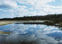 The Pedja in spring | |
| Country | Estonia |
| Physical characteristics | |
| Main source | Simuna, Lääne-Viru County |
| River mouth |
Emajõgi 33 m (108 ft) |
| Length | 122 km (76 mi) |
| Discharge |
|
| Basin features | |
| Basin size | 2,719 km2 (1,050 sq mi) |
The Pedja (Estonian: Pedja jõgi) is the fourth longest river in Estonia. Its source is near Simuna on the southern slopes of the Pandivere Upland. The river flows for 122 km through Lääne-Viru, Jõgeva and Tartu counties before joining the Emajõgi northeast of Lake Võrtsjärv. The last 4 km section of the river after confluence with Põltsamaa is known as the Pede. The largest settlement on the river is Jõgeva.
The Pedja is also the origin of the name of Alam-Pedja Nature Reserve, a large protected area on the river's lower reaches.
| Wikimedia Commons has media related to Pedja River. |
References
- (in Estonian) Pedja jõgi
Coordinates: 58°24′51.12″N 26°11′19.79″E / 58.4142000°N 26.1888306°E
This article is issued from
Wikipedia.
The text is licensed under Creative Commons - Attribution - Sharealike.
Additional terms may apply for the media files.