Pasym
| Pasym | |||
|---|---|---|---|
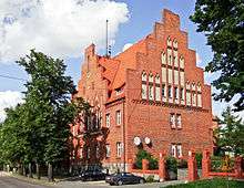
 Town Hall | |||
| |||
 Pasym | |||
| Coordinates: 53°38′52″N 20°47′27″E / 53.64778°N 20.79083°ECoordinates: 53°38′52″N 20°47′27″E / 53.64778°N 20.79083°E | |||
| Country |
| ||
| Voivodeship | Warmian-Masurian | ||
| County | Szczytno | ||
| Gmina | Pasym | ||
| Area | |||
| • Total | 15.18 km2 (5.86 sq mi) | ||
| Population (2006) | |||
| • Total | 2,550 | ||
| • Density | 170/km2 (440/sq mi) | ||
| Postal code | 12-130 | ||

Pasym ([ˈpasɨm]; German: Passenheim) is a small town in Szczytno County, Warmian-Masurian Voivodeship, Poland, with 2,522 inhabitants (2004).
History
A small settlement named Heinrichswalde was first mentioned in 1381. In 1386 this settlement was renamed Passenheim after the Teutonic Knight Heinrich Walpot von Passenheim from modern Bassenheim near Koblenz.[1]
The town was destroyed by the Polish Tatar raids in 1656, which has been described by Christoph Hartknoch (1644–1687).[1]
Before 1945 the area was part of the German province of East Prussia. In the East Prussian plebiscite of 1920 the inhabitants voted to remain in Germany.[2] After World War II the region was placed under Polish administration by the Potsdam Agreement under territorial changes demanded by the Soviet Union. Most Germans fled or were expelled and replaced with Poles expelled from the Polish territories annexed by the Soviet Union or Ukrainians forced to settle in the area through Operation Vistula in 1947.
Notable residents
- Johann Wilhelm Ebel (1784–1861), Lutheran clergyman and teacher
- Marie-Luise Gothein (1863–1931), scholar, gardener and author
- Christoph Hartknoch (1644-1687), teacher, historian, author
- Friedrich-Wilhelm Morzik (1891-1985), Luftwaffe general
International relations
Twin towns — sister cities
Pasym is twinned with:
References
- 1 2 Kossert, Andreas (2001). Masuren, Ostpreußens vergessener Süden. pp. 37ff. ISBN 3-570-55006-0.
- ↑ Passenheim
- ↑ Bassenheim.de Archived 2011-07-28 at the Wayback Machine.
| Town and seat |  | |
|---|---|---|
| Villages | ||
| Wikimedia Commons has media related to Pasym. |