Papamoa
| Papamoa Beach | |
|---|---|
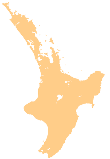 Papamoa Beach Papamoa Beach's location within the North Island | |
| Coordinates: 37°44′S 176°18′E / 37.733°S 176.300°ECoordinates: 37°44′S 176°18′E / 37.733°S 176.300°E | |
| Country |
|
| Region | Bay of Plenty |
| Territorial authority | Tauranga City |
| Postcode(s) | 3118 |
Papamoa Beach is a suburb of Tauranga, located about 11 kilometres from the city centre. It is the largest residential suburb in Tauranga, having a population of 20,091 at the 2013 census.[1] It is bordered to the west by Mount Maunganui (east of Sunrise Avenue and Hibiscus Avenue), the east by the Kaituna River (separating it from the Western Bay of Plenty District) and to the south by State Highway 2. Papamoa Beach has 16km of white sandy beach stretching from the boundary with Mount Maunganui in the west to the Kaituna River in the east. Widespread settlement of the area did not start until the early 1980s and prior to this Papamoa Beach had been largely a rural area. Once a small and tight knit community, many of Papamoa Beach's sweeping paddocks have been swallowed up by urban development. Papamoa Beach is currently one of the fastest growing suburbs of Tauranga, with many different subdivisions developing concurrently on different blocks of land on the fringes of the suburb.
Papamoa Beach is renowned as a popular fishing, surfing, and holiday retreat. The population in Papamoa Beach (alongside neighbouring Mount Maunganui) grows significantly during the busy summer months.
In 2012, Papamoa Beach was the location for a skinny dipping world record attempt. On 2 December 2012, 299 people got naked in the water as the nearby Baywatch campsite in Gisborne hosted the event. Despite a cold day, lots of people stripped naked attempting to beat Christchurch's Summer Beach Dip. The record failed as Guinness World Records required all swimmers to be in the water at the same time for a group photo.[2] The skinny dips follow a recent court decision upholding the right to be naked in public for innocent reasons.
Name issues
The suburban area of "Papamoa" as it is commonly referred to today is actually situated at "Papamoa Beach." Strictly geographically speaking, "Papamoa" is actually located closer inland towards the Papamoa Hills, in an area covered by the Western Bay of Plenty District Council. Papamoa (situated at Papamoa Beach) can be split into two areas: Papamoa East and Papamoa West. Legally speaking Domain Road separates Papamoa West from Papamoa East, although to many locals Papamoa East starts on the Eastern side of Parton Road. Papamoa East (of Parton Road) in the 1970s and 1980s used to be seen as more of an alternative place to live, a bit like the Coromandel Peninsula.
Commercial activity
Papamoa Beach has a large shopping area located to the west of Domain Road, containing the Papamoa Plaza shopping centre, as well as a number of other retailers, including the Fashion Island shopping area (located south of Gravatt Road). There is a small section of industrial activity located to the east of Parton Road. The construction of the Tauranga Eastern Link, which was completed in 2016, provided many jobs in the area.
Education
Papamoa Beach has five schools.
- Golden Sands School is a state contributing primary (Year 1–6) school, and has 598 students as of August 2018.[3] The school opened in February 2011.
- Papamoa College is a state Year 7–13 secondary school, and has 1294 students as of August 2018.[3] The school opened in February 2011.
- Papamoa School is a state contributing primary (Year 1–6) school, and has 615 students as of August 2018.[3]
- Tahatai Coast School is a state full primary (Year 1–8) school, and has 724 students as of August 2018.[3] The school opened in 1996.
- Te Akau ki Papamoa Primary School is a state contributing primary (Year 1–6) school, and has 661 students as of August 2018.[3] The school opened in 2000 as a full primary (Year 1–8) school; Years 7 and 8 were removed when Papamoa College opened in 2011.
Transport
Public transport in Papamoa Beach solely consists of bus services. The suburb is served by three 'Bay Hopper' routes; Route 30 (Mount Maunganui - Papamoa), Route 33 (Tauranga - Papamoa via the Harbour Bridge), and Route 36 (Tauranga - Papamoa via Maungatapu Bridge).[4]
Gallery
 Mt Maunganui from Papamoa Beach
 Papamoa Beach from the Papamoa Domain
 The Papamoa Hills from Domain Rd
 Looking towards Mt Maunganui from the Papamoa Hills
 Looking towards Mayor Island down Domain Rd from the Papamoa Hills
 Looking down at Papamoa from the top of the Papamoa Hills
 Looking towards Parton Rd and Motiti Island from the Papamoa Hills
References
- ↑ "Papamoa set for growth boom". Bay of Plenty Times. 12 July 2015.
- ↑ Gillespie, Kiri (3 December 2012). "Skinny dippers brave chill in record attempt". Bay of Plenty Times.
- 1 2 3 4 5 "Directory of Schools - as at 13 September 2018". New Zealand Ministry of Education. Retrieved 22 September 2018.
- ↑ "Bus Timetables for Tauranga, Rotorua, Whakatane, Te Puke, Katikati". Baybus.co.nz. Retrieved 2015-05-20.