Pâlis
| Palis | |
|---|---|
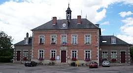 Town hall | |
 Palis Location within Grand Est region  Palis | |
| Coordinates: 48°17′19″N 3°42′34″E / 48.2886°N 3.7094°ECoordinates: 48°17′19″N 3°42′34″E / 48.2886°N 3.7094°E | |
| Country | France |
| Region | Grand Est |
| Department | Aube |
| Arrondissement | Troyes |
| Canton | Marcilly-le-Hayer |
| Intercommunality | Pays d'Othe aixois |
| Government | |
| • Mayor (2008–2014) | Roland Broquet |
| Area1 | 20.89 km2 (8.07 sq mi) |
| Population (2007)2 | 603 |
| • Density | 29/km2 (75/sq mi) |
| Time zone | UTC+1 (CET) |
| • Summer (DST) | UTC+2 (CEST) |
| INSEE/Postal code | 10277 /10190 |
| Elevation |
165–269 m (541–883 ft) (avg. 166 m or 545 ft) |
|
1 French Land Register data, which excludes lakes, ponds, glaciers > 1 km2 (0.386 sq mi or 247 acres) and river estuaries. 2 Population without double counting: residents of multiple communes (e.g., students and military personnel) only counted once. | |
Pâlis, officially Palis, is a former commune in the Aube department in north-central France. On 1 January 2016, it was merged into the new commune Aix-Villemaur-Pâlis.[1]
Population
| Historical population | ||
|---|---|---|
| Year | Pop. | ±% |
| 1962 | 550 | — |
| 1968 | 602 | +9.5% |
| 1975 | 548 | −9.0% |
| 1982 | 511 | −6.8% |
| 1990 | 486 | −4.9% |
| 1999 | 555 | +14.2% |
| 2008 | 603 | +8.6% |
See also
References
- ↑ Arrêté préfectoral 15 December 2015 (in French)
| Wikimedia Commons has media related to Pâlis. |
This article is issued from
Wikipedia.
The text is licensed under Creative Commons - Attribution - Sharealike.
Additional terms may apply for the media files.