Padarali
| Padarli पादरली Padarli | |
|---|---|
| village | |
 Padarli Location in Rajasthan, India  Padarli Padarli (India) | |
| Coordinates: 25°24′00″N 72°59′00″E / 25.4000°N 72.9833°ECoordinates: 25°24′00″N 72°59′00″E / 25.4000°N 72.9833°E | |
| Country |
|
| State | Rajasthan |
| District | Jalor |
| Elevation | 197 m (646 ft) |
| Population (2001) | |
| • Total | 3,099 |
| Languages | |
| • Official | Hindi |
| Time zone | UTC+5:30 (IST) |
| PIN | 307030 |
| Telephone code | +912978 |
| ISO 3166 code | RJ-IN |
| Vehicle registration | RJ-16 |
| Sex ratio | 1067 ♂/♀ |
Padarli is a village in Ahore tehsil of Jalore District of Rajasthan state in India. It is situated near the town Takhatgarh. There is a majority of people belonging to the Bhomiya
Rajput community.(Deora , Rathore , Sankhla, Solanki, Dahiya, ballot, Parihar , Parmar , chouhan , sindal )
Geography
Padarli is located at 25°24′00″N 72°59′00″E / 25.4000°N 72.9833°E.[1]
Demographics
Population of Padarli is 3,099 according to census 2001. The male population is 1,499 while the female population is 1,600.[2]
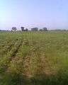 This is a farm of Mohit
 Shri Ambikadevi, Padarli, Rajasthan.
References
This article is issued from
Wikipedia.
The text is licensed under Creative Commons - Attribution - Sharealike.
Additional terms may apply for the media files.