Pacoorcco (Moquegua)
| Pacoorcco | |
|---|---|
 | |
| Highest point | |
| Elevation | 4,940 m (16,210 ft) [1] |
| Coordinates | 16°18′10″S 70°49′2″W / 16.30278°S 70.81722°WCoordinates: 16°18′10″S 70°49′2″W / 16.30278°S 70.81722°W |
| Geography | |
 Pacoorcco Peru | |
| Location | Peru, Moquegua Region, General Sánchez Cerro Province |
| Parent range | Andes |
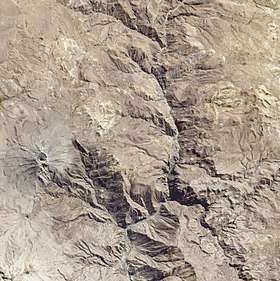
Pacoorcco (possibly from Quechua p'aqu blond, fair, a color similar to gold, urqu mountain,[2] "'blond' or slightly golden mountain") erroneously also Poocoorco, is a 4,940-metre-high (16,207 ft) mountain in the Andes of Peru. The mountain is located in the Moquegua Region, General Sánchez Cerro Province, Ubinas District, north-east of the active volcano Ubinas and south of the mountain Pirhuane.[3]
References
- ↑ Valoración del Servicio Ambiental de Provisión de Agua con Base en la Reserva Nacional Salinas y Aguada Blanca - Cuenca del Río Chili, PROFONANPE, Lima, 2007
- ↑ Teofilo Laime Ajacopa, Diccionario Bilingüe Iskay simipi yuyayk'ancha, La Paz, 2007 (Quechua-Spanish dictionary)
- ↑ escale.minedu.gob.pe - UGEL map of the General Sánchez Cerro (Moquegua Region)
This article is issued from
Wikipedia.
The text is licensed under Creative Commons - Attribution - Sharealike.
Additional terms may apply for the media files.