Ouled Sellam
| Ouled Sellam | |
|---|---|
| Nickname(s): Ouled Sellem | |
 M'cil, Ouled Sellam | |
| Coordinates: 0°49′32″N 5°52′56″E / 0.82556°N 5.88222°E | |
| Country | Algeria |
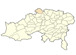
| Province | Batna |
| Government | |
| • Ghenam | Ghenam |
| Elevation | 1,000 m (3,000 ft) |
| Chaoui | |
| Time zone | UTC+1 (West Africa Time) |
Ouled Sellam council "Commune" is situated in north-eastern Algeria, about 70 km on the RN77 way north-west of Batna province by the borders with "Setif". The main village is called M'cil, where the local council and schools are, also a hospital and a football stadium.

Coordinates: 35°49′32″N 5°52′56″E / 35.82556°N 5.88222°E
This article is issued from
Wikipedia.
The text is licensed under Creative Commons - Attribution - Sharealike.
Additional terms may apply for the media files.