Mount Satima
| Mount Satima | |
|---|---|
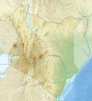 Mount Satima Location in Kenya | |
| Highest point | |
| Elevation | 4,001 m (13,127 ft) [1][2] |
| Prominence | 2,081 m (6,827 ft) [1] |
| Listing | Ultra |
| Coordinates | 0°20′59″S 36°37′00″E / 0.34972°S 36.61667°ECoordinates: 0°20′59″S 36°37′00″E / 0.34972°S 36.61667°E |
| Geography | |
| Location | Kenya |
| Parent range | Aberdare Range |
Mount Satima, also known as Mount Lesatima and often abbreviated to Satima or Lesatima, is the third-highest mountain in Kenya and the highest in the Aberdare Range. The Maasai name is Oldoinyo Lesatima, which has a variety of alternative spellings, such as Ol Donyo Le Satima, and means "mountain of the bull calf".[3]
The peak lies at the northern end of the Aberdares, which themselves are along the eastern side of the Great Rift Valley, and is their highest point. Around it stand a number of sharp volcanic cones called "the Dragon's Teeth".[4] There are moraines between 3,600 and 3,800 metres on the north west of the mountain.[5] One book on Kenya has called the mountain itself "a craggy bluff of rock and tussock grass around which the clouds swirl".[6]
See also
References
- 1 2 "Africa Ultra-Prominences" Peaklist.org. Listed as "Oldoinyo Lesatima". Retrieved 2012-01-10.
- ↑ New Encyclopædia Britannica vol. 1 (2005): "The range has an average elevation of 11000 feet (3350 m) and culminates in Oldoinyo Lesatima (13120 feet [3999 m]) and Ilkinangop (12815 feet [3906 m])."
- ↑ Mary Fitzpatrick, Matthew Fletcher, David Wenk, Trekking in East Africa (Lonely Planet Publications, 2003), p. 190
- ↑ Fodor's Kenya, Tanzania, Seychelles (Fodor's Travel Publications, 1990), p. 65
- ↑ S. Hastenrath, The glaciers of equatorial East Africa (1984), p. 58
- ↑ Mohamed Amin, Duncan Willetts, Brian Tetley, Kenya: the magic land (Bodley Head, 1988), p. 126
External links
- Weather for Oldoinyo Lesatima at weather.excite.co.uk