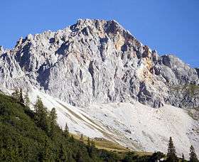
Oberreintalschrofen
| Oberreintalschrofen | |
|---|---|
 | |
| Highest point | |
| Elevation | 2,523 m (8,278 ft) |
| Coordinates | 47°23′44″N 11°6′16″E / 47.39556°N 11.10444°ECoordinates: 47°23′44″N 11°6′16″E / 47.39556°N 11.10444°E |
| Geography | |
| Location | Bavaria, Germany and Tyrol, Austria |
| Parent range | Northern Limestone Alps |
Oberreintalschrofen (Upper Rhine Crag) is a mountain on the border of Bavaria, Germany and Tyrol, Austria. The first recorded ascent was by Hermann von Barth.
This article is issued from
Wikipedia.
The text is licensed under Creative Commons - Attribution - Sharealike.
Additional terms may apply for the media files.