Norvell Township, Michigan
| Norvell Township, Michigan | |
|---|---|
| Township | |
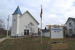 Norvell Township Hall | |
 Norvell Township  Norvell Township | |
| Coordinates: 42°8′N 84°10′W / 42.133°N 84.167°WCoordinates: 42°8′N 84°10′W / 42.133°N 84.167°W | |
| Country | United States |
| State | Michigan |
| County | Jackson |
| Area | |
| • Total | 32.17 sq mi (83.31 km2) |
| • Land | 29.53 sq mi (76.49 km2) |
| • Water | 2.63 sq mi (6.82 km2) |
| Elevation | 925 ft (282 m) |
| Population (2010) | |
| • Total | 2,963 |
| • Density | 100/sq mi (38.7/km2) |
| Time zone | UTC-5 (Eastern (EST)) |
| • Summer (DST) | UTC-4 (EDT) |
| ZIP code |
49263 (Norvell P.O. Box), 49230 (Brooklyn), 49240 (Grass Lake) |
| Area code(s) | 517 |
| FIPS code | 26-59180[1] |
| GNIS feature ID | 1626820[2] |
| Website |
norvelltownship |
Norvell Township is a civil township of Jackson County in the U.S. state of Michigan. The population was 2,963 at the 2010 census.[3] The township is named after John Norvell, one of Michigan's first U.S. senators.
Communities
- Norvell is an unincorporated community in the township at 42°9′N 84°11′W / 42.150°N 84.183°W.[4] It is situated at the outlet of Norvell Lake on the River Raisin. William Hunt, the first white settler in the area, arrived in 1831. A post office was established on March 17, 1838, with Harvey Austin as the first postmaster. It was a station on the Lake Shore and Michigan Southern Railway in 1878. The community was named for John Norvell, one of the first U.S. senators from Michigan.[5]
- The village of Brooklyn is to the southwest in Columbia Township, and the Brooklyn post office, with ZIP code 49230, serves most of southern Norvell Township.[6]
- The village of Grass Lake is to the north in Grass Lake Charter Township, and the Grass Lake post office, with ZIP code 49240, serves portions of northern Norvell Township.[7]
Geography
Norvell Township occupies the southeast corner of Jackson County. It is bordered to the east by Washtenaw County and to the south by Lenawee County. It is 15 miles (24 km) southeast of Jackson, the county seat.
According to the United States Census Bureau, the township has a total area of 32.2 square miles (83.3 km2), of which 29.5 square miles (76.5 km2) are land and 2.6 square miles (6.8 km2), or 8.19%, are water.[3]
The township contains 717 acres (290 ha) of Watkins Lake State Park and County Preserve, owned by the Michigan Department of Natural Resources.[8]
Demographics
As of the census[1] of 2000, there were 2,922 people, 1,135 households, and 831 families residing in the township. The population density was 97.4 per square mile (37.6/km²). There were 1,568 housing units at an average density of 52.2 per square mile (20.2/km²). The racial makeup of the township was 97.26% White, 0.62% African American, 0.51% Native American, 0.10% Asian, 0.14% from other races, and 1.37% from two or more races. Hispanic or Latino of any race were 0.68% of the population.
There were 1,135 households out of which 29.8% had children under the age of 18 living with them, 63.9% were married couples living together, 5.7% had a female householder with no husband present, and 26.7% were non-families. 22.2% of all households were made up of individuals and 8.2% had someone living alone who was 65 years of age or older. The average household size was 2.56 and the average family size was 3.00.
In the township the population was spread out with 23.9% under the age of 18, 6.0% from 18 to 24, 27.6% from 25 to 44, 29.0% from 45 to 64, and 13.6% who were 65 years of age or older. The median age was 41 years. For every 100 females, there were 107.1 males. For every 100 females age 18 and over, there were 107.9 males.
The median income for a household in the township was $49,167, and the median income for a family was $55,221. Males had a median income of $45,756 versus $29,625 for females. The per capita income for the township was $20,488. About 6.9% of families and 6.6% of the population were below the poverty line, including 3.3% of those under age 18 and 14.2% of those age 65 or over.
Gallery
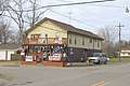 Norvell General Store
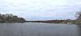 Norvell Lake
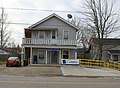 US Post Office
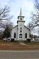 Community Baptist Church
References
- 1 2 "American FactFinder". United States Census Bureau. Retrieved 2008-01-31.
- ↑ U.S. Geological Survey Geographic Names Information System: Norvell Township, Michigan
- 1 2 "Geographic Identifiers: 2010 Census Summary File 1 (G001): Norvell township, Jackson County, Michigan". American Factfinder. U.S. Census Bureau. Retrieved July 30, 2018.
- ↑ U.S. Geological Survey Geographic Names Information System: Norvell, Michigan
- ↑ Romig, Walter (1986) [1973]. Michigan Place Names. Detroit, Michigan: Wayne State University Press. ISBN 0-8143-1838-X.
- ↑ 49230 5-Digit ZCTA, 492 3-Digit ZCTA - Reference Map - American FactFinder, U.S. Census Bureau, 2000 census
- ↑ 49240 5-Digit ZCTA, 492 3-Digit ZCTA - Reference Map - American FactFinder, U.S. Census Bureau, 2000 census
- ↑ "Watkins Lake State Park & County Preserve dedicated in ribbon-cutting ceremony". The Manchester Mirror. October 31, 2016. Retrieved January 14, 2017.
External links
Municipalities and communities of Jackson County, Michigan, United States | ||
|---|---|---|
| City |  | |
| Villages | ||
| Charter townships | ||
| General law townships | ||
| CDPs | ||
| Other unincorporated communities | ||
| Footnotes | ‡This populated place also has portions in an adjacent county or counties | |