| [3] |
Name on the Register[4] |
Image |
Date listed[5] |
Location |
City or town |
Description |
|---|
| 1 |
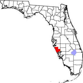
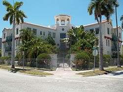
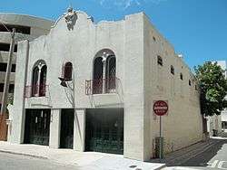
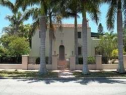
American National Bank Building |
|
September 9, 1998
(#98001154) |
1330 Main Street
27°20′06″N 82°32′37″W / 27.335°N 82.543611°W / 27.335; -82.543611 (American National Bank Building) |
Sarasota |
|
| 2 |
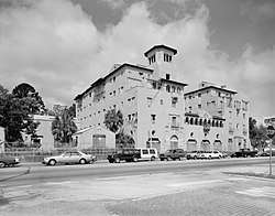
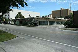
Appleby Building |
|
June 28, 2001
(#01000683) |
501-513 Kumquat Court
27°20′24″N 82°32′26″W / 27.34°N 82.540556°W / 27.34; -82.540556 (Appleby Building) |
Sarasota |
|
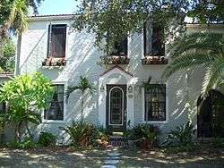
| 3 |
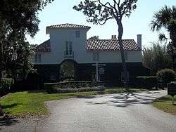
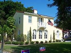
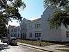
William Martin Armistead House |
|
March 30, 2009
(#09000165) |
1510 Hyde Park Street
27°18′55″N 82°32′22″W / 27.315278°N 82.539583°W / 27.315278; -82.539583 (William Martin Armistead House) |
Sarasota |
|
| 4 |
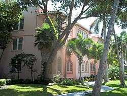
Armada Road Multi-Family District |
|
December 18, 1989
(#89002049) |
Roughly bounded by Granada Avenue, Harbor Drive South, Armada Road South, and Park Boulevard South
27°05′48″N 82°26′58″W / 27.096667°N 82.449444°W / 27.096667; -82.449444 (Armada Road Multi-Family District) |
Venice |
Part of the Venice MPS |
| 5 |
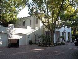
Bacheller-Brewer Model Home Estate |
|
February 10, 1992
(#91002034) |
1903 Lincoln Drive
27°19′31″N 82°31′55″W / 27.325278°N 82.531944°W / 27.325278; -82.531944 (Bacheller-Brewer Model Home Estate) |
Sarasota |
|
| 6 |
Bacon and Tomlin, Inc. |
|
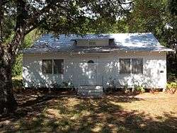
March 22, 1984
(#84003829) |
201 South Palm Avenue
27°20′02″N 82°32′30″W / 27.333889°N 82.541667°W / 27.333889; -82.541667 (Bacon and Tomlin, Inc.) |
Sarasota |
Part of the Sarasota MRA |
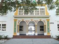
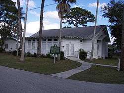
| 7 |
Bay Haven School |
|
April 23, 1984
(#84003832) |
2901 West Tamiami Circle
27°21′42″N 82°33′06″W / 27.361667°N 82.551667°W / 27.361667; -82.551667 (Bay Haven School) |
Sarasota |
Part of the Sarasota MRA |
| 8 |
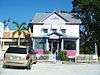
Bee Ridge Woman's Club |
|
February 10, 1995
(#95000052) |
4919 Andrew Avenue
27°16′53″N 82°29′03″W / 27.281389°N 82.484167°W / 27.281389; -82.484167 (Bee Ridge Woman's Club) |
Sarasota |
|
| 9 |
Frank and Matilda Binz House |
|
August 5, 1994
(#94000736) |
5050 Bay Shore Road
27°22′40″N 82°33′36″W / 27.377778°N 82.56°W / 27.377778; -82.56 (Frank and Matilda Binz House) |
Sarasota |
|
| 10 |
Bispham-Wilson Historic District |
|
September 14, 2002
(#02001010) |
4613 South Tamiami Trail
27°17′10″N 82°31′54″W / 27.286111°N 82.531667°W / 27.286111; -82.531667 (Bispham-Wilson Historic District) |
Sarasota |
|
| 11 |
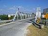
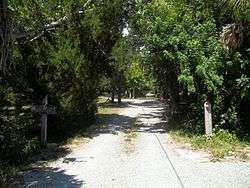
Blackburn Point Bridge |
|
March 29, 2001
(#01000290) |
Blackburn Point Road at the Gulf Intracoastal Waterway
27°10′46″N 82°29′41″W / 27.179444°N 82.494722°W / 27.179444; -82.494722 (Blackburn Point Bridge) |
Osprey |
|
| 12 |
Blalock House |
|
April 12, 1989
(#89000235) |
241 South Harbor Drive
27°05′49″N 82°26′59″W / 27.096944°N 82.449722°W / 27.096944; -82.449722 (Blalock House) |
Venice |
Part of the Venice MPS |
| 13 |
Bryson-Crane House |
|
June 1, 2005
(#05000501) |
5050 Brywill Circle
27°22′39″N 82°33′34″W / 27.3775°N 82.559444°W / 27.3775; -82.559444 (Bryson-Crane House) |
Sarasota |
|
| 14 |
Burns Court Historic District |
|
March 22, 1984
(#84003830) |
400-446 Burns Court and 418, 426, and 446 South Pineapple Avenue
27°20′03″N 82°32′23″W / 27.334167°N 82.539722°W / 27.334167; -82.539722 (Burns Court Historic District) |
Sarasota |
Part of the Sarasota MRA |
| 15 |
Burns Realty Company-Karl Bickel House |
|
March 5, 1987
(#87000196) |
101 North Tamiami Trail
27°20′13″N 82°32′50″W / 27.336944°N 82.547222°W / 27.336944; -82.547222 (Burns Realty Company-Karl Bickel House) |
Sarasota |
Part of the Sarasota MRA |
| 16 |
William J. Burns House |
|
March 21, 1997
(#97000248) |
47 South Washington Drive
27°19′07″N 82°34′27″W / 27.318611°N 82.574167°W / 27.318611; -82.574167 (William J. Burns House) |
Sarasota |
|
| 17 |
Waters and Elsa Burrows Historic District |
|
February 3, 2012
(#11001077) |
400 Palmetto Avenue
27°12′09″N 82°29′36″W / 27.202454°N 82.493432°W / 27.202454; -82.493432 (Waters and Elsa Burrows Historic District) |
Osprey |
|
| 18 |
Caples'-Ringlings' Estates Historic District |
|
December 15, 1982
(#82001039) |
Roughly bounded by Sarasota Bay, U.S. Route 41, Parkview, and North Shore Avenue
27°22′58″N 82°33′40″W / 27.382778°N 82.561111°W / 27.382778; -82.561111 (Caples'-Ringlings' Estates Historic District) |
Sarasota |
|
| 19 |
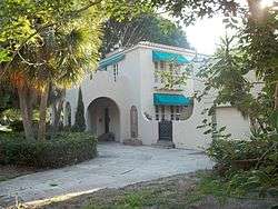
Casa Del Mar |
|
February 14, 1997
(#97000051) |
25 South Washington Drive
27°19′09″N 82°34′28″W / 27.319167°N 82.574444°W / 27.319167; -82.574444 (Casa Del Mar) |
Sarasota |
|
| 20 |
Central-Cocoanut Historic District |
|
June 17, 2005
(#05000599) |
11th Street, Tamiami Trail, 22nd Street, and railroad tracks
27°21′05″N 82°32′38″W / 27.351389°N 82.543889°W / 27.351389; -82.543889 (Central-Cocoanut Historic District) |
Sarasota |
|
| 21 |
Chidsey Library |
|
May 4, 2011
(#11000241) |
701 North Tamiami Trail
27°20′32″N 82°32′51″W / 27.3423°N 82.5476°W / 27.3423; -82.5476 (Chidsey Library) |
Sarasota |
|
| 22 |
City Waterworks |
|
April 23, 1984
(#84003831) |
1015 North Orange Avenue
27°20′41″N 82°32′22″W / 27.344722°N 82.539444°W / 27.344722; -82.539444 (City Waterworks) |
Sarasota |
Part of the Sarasota MRA |
| 23 |
Corrigan House |
|
May 26, 1994
(#94000528) |
463 Sapphire Drive
27°22′41″N 82°33′46″W / 27.378056°N 82.562778°W / 27.378056; -82.562778 (Corrigan House) |
Sarasota |
|
| 24 |
Crisp Building |
|
April 21, 2000
(#00000388) |
1970 Main Street
27°20′12″N 82°31′52″W / 27.336667°N 82.531111°W / 27.336667; -82.531111 (Crisp Building) |
Sarasota |
|
| 25 |
F. A. DeCanizares House |
|
March 22, 1984
(#84003833) |
1215 North Palm Avenue
27°20′11″N 82°32′46″W / 27.336389°N 82.546111°W / 27.336389; -82.546111 (F. A. DeCanizares House) |
Sarasota |
Part of the Sarasota MRA |
| 26 |
DeMarcay Hotel |
|
March 22, 1984
(#84003834) |
27 South Palm Avenue
27°20′04″N 82°32′27″W / 27.334444°N 82.540833°W / 27.334444; -82.540833 (DeMarcay Hotel) |
Sarasota |
Part of the Sarasota MRA |
| 27 |
Downtown Sarasota Historic District |
|
April 9, 2009
(#09000183) |
Bound by 1st Street, Orange Avenue, State Street, Gulf Stream Avenue, and North Pineapple Avenue
27°19′58″N 82°32′14″W / 27.332778°N 82.537222°W / 27.332778; -82.537222 (Downtown Sarasota Historic District) |
Sarasota |
Boundary decrease (listed October 7, 2010): 1400 block of Main St. |
| 28 |
Eagle Point Historic District |
|
October 3, 1991
(#91001448) |
759 North Tamiami Trail
27°06′31″N 82°26′46″W / 27.108611°N 82.446111°W / 27.108611; -82.446111 (Eagle Point Historic District) |
Venice |
|
| 29 |
Earle House |
|
September 2, 1993
(#93000908) |
4521 Bayshore Road
27°22′24″N 82°33′44″W / 27.373333°N 82.562222°W / 27.373333; -82.562222 (Earle House) |
Sarasota |
|
| 30 |
Edgewood Historic District |
|
December 18, 1989
(#89002048) |
Roughly bounded by School Street, Myrtle Avenue, the Venice-By-Way, and Groveland Avenue
27°05′46″N 82°25′51″W / 27.096111°N 82.430833°W / 27.096111; -82.430833 (Edgewood Historic District) |
Venice |
Part of the Venice MPS |
| 31 |
Edwards Theatre |
|
March 22, 1984
(#84003835) |
57 North Pineapple Avenue
27°20′12″N 82°32′38″W / 27.336667°N 82.543889°W / 27.336667; -82.543889 (Edwards Theatre) |
Sarasota |
Part of the Sarasota MRA |
| 32 |
El Patio Apartments |
|
May 6, 1993
(#93000390) |
500 North Audubon Place
27°20′25″N 82°31′37″W / 27.340278°N 82.526944°W / 27.340278; -82.526944 (El Patio Apartments) |
Sarasota |
|
| 33 |
El Vernona Apartments-Broadway Apartments |
|
March 22, 1984
(#84003836) |
1133 4th Street
27°20′23″N 82°32′54″W / 27.339722°N 82.548333°W / 27.339722; -82.548333 (El Vernona Apartments-Broadway Apartments) |
Sarasota |
Part of the Sarasota MRA |
| 34 |
El Vernona Hotel-John Ringling Hotel |
|
March 5, 1987
(#87000197) |
111 North Tamiami Trail
27°20′13″N 82°32′50″W / 27.336944°N 82.547222°W / 27.336944; -82.547222 (El Vernona Hotel-John Ringling Hotel) |
Sarasota |
Part of the Sarasota MRA |
| 35 |
Field Estate |
|
June 5, 1986
(#86001238) |
Field Road and Camino Real
27°17′11″N 82°32′20″W / 27.286389°N 82.538889°W / 27.286389; -82.538889 (Field Estate) |
Sarasota |
|
| 36 |
Frances-Carlton Apartments |
|
March 22, 1984
(#84003837) |
1221-1227 North Palm Avenue
27°20′11″N 82°32′46″W / 27.336389°N 82.546111°W / 27.336389; -82.546111 (Frances-Carlton Apartments) |
Sarasota |
Part of the Sarasota MRA |
| 37 |
Dr. Joseph Halton House |
|
March 22, 1984
(#84003838) |
308 Cocoanut Avenue
27°20′19″N 82°32′41″W / 27.338611°N 82.544722°W / 27.338611; -82.544722 (Dr. Joseph Halton House) |
Sarasota |
Part of the Sarasota MRA |
| 38 |
Harding Circle Historic District |
|
January 16, 2001
(#00001650) |
Roughly John Ringling Boulevard, St. Armands Circle, and Boulevard of Presidents
27°19′08″N 82°34′37″W / 27.318889°N 82.576944°W / 27.318889; -82.576944 (Harding Circle Historic District) |
Sarasota |
|
| 39 |
Hermitage-Whitney Historic District |
|
October 31, 2002
(#02001261) |
6660 Manasota Key Road
26°57′40″N 82°23′03″W / 26.961111°N 82.384167°W / 26.961111; -82.384167 (Hermitage-Whitney Historic District) |
Englewood |
|
| 40 |
Hotel Venice |
|
February 6, 1984
(#84000961) |
200 North Nassau Street
27°06′01″N 82°27′11″W / 27.100278°N 82.453056°W / 27.100278; -82.453056 (Hotel Venice) |
Venice |
|
| 41 |
House at 507 Jackson Drive |
|
February 5, 1998
(#98000060) |
507 Jackson Drive
27°19′00″N 82°34′31″W / 27.316667°N 82.575278°W / 27.316667; -82.575278 (House at 507 Jackson Drive) |
Sarasota |
|
| 42 |
House at 710 Armada Road South |
|
August 17, 1989
(#89001073) |
710 Armada Road South
27°05′52″N 82°26′49″W / 27.097778°N 82.446944°W / 27.097778; -82.446944 (House at 710 Armada Road South) |
Venice |
Part of the Venice MPS |
| 43 |
Johnson Chapel Missionary Baptist Church |
|
October 8, 1997
(#97001218) |
506 Church Street
27°07′49″N 82°26′54″W / 27.130278°N 82.448333°W / 27.130278; -82.448333 (Johnson Chapel Missionary Baptist Church) |
Laurel |
|
| 44 |
Johnson-Schoolcraft Building |
|
December 27, 1996
(#96001522) |
201-203 West Venice Avenue
27°06′16″N 82°27′07″W / 27.104444°N 82.451944°W / 27.104444; -82.451944 (Johnson-Schoolcraft Building) |
Venice |
Part of the Venice MPS |
| 45 |
Edson Keith Estate |
|
March 14, 1991
(#91000282) |
5500 South Tamiami Trail
27°16′13″N 82°31′58″W / 27.270278°N 82.532778°W / 27.270278; -82.532778 (Edson Keith Estate) |
Sarasota |
|
| 46 |
Dr. Walter Kennedy House |
|
April 14, 1994
(#94000349) |
1876 Oak Street
27°19′53″N 82°31′59″W / 27.331389°N 82.533056°W / 27.331389; -82.533056 (Dr. Walter Kennedy House) |
Sarasota |
|
| 47 |
S. H. Kress Building |
|
March 22, 1984
(#84003839) |
1442 Main Street
27°20′09″N 82°32′31″W / 27.335833°N 82.541944°W / 27.335833; -82.541944 (S. H. Kress Building) |
Sarasota |
Part of the Sarasota MRA |
| 48 |
Laurel Park Historic District |
|
March 11, 2008
(#08000164) |
Bounded by Morrill Street, Orange Avenue, Brother Geenen Way, Julia Place, and Lafayette Court
27°19′52″N 82°32′05″W / 27.331111°N 82.534722°W / 27.331111; -82.534722 (Laurel Park Historic District) |
Sarasota |
|
| 49 |
Hilton Leech House and Amagansett Art School |
|
June 22, 1995
(#95000732) |
1666 Hillview Street
27°18′59″N 82°32′10″W / 27.316389°N 82.536111°W / 27.316389; -82.536111 (Hilton Leech House and Amagansett Art School) |
Sarasota |
|
| 50 |
Lemon Bay Woman's Club |
|
August 11, 1988
(#88001150) |
51 North Maple Street
26°57′47″N 82°21′29″W / 26.963056°N 82.358056°W / 26.963056; -82.358056 (Lemon Bay Woman's Club) |
Englewood |
|
| 51 |
Levillain-Letton House |
|
April 12, 1989
(#89000234) |
229 South Harbor Drive
27°05′50″N 82°26′59″W / 27.097222°N 82.449722°W / 27.097222; -82.449722 (Levillain-Letton House) |
Venice |
Part of the Venice MPS |
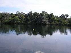
| 52 |
Little Salt Springs |
|
July 10, 1979
(#79000692) |
Off U.S. Route 41
27°04′29″N 82°14′00″W / 27.074722°N 82.233333°W / 27.074722; -82.233333 (Little Salt Springs) |
North Port |
|
| 53 |
Maine Colony Historic District |
|
October 5, 2005
(#05001118) |
Bounded by Swift Road Ashton Road, Portland Way and Grafton Street
27°16′47″N 82°31′06″W / 27.279722°N 82.518333°W / 27.279722; -82.518333 (Maine Colony Historic District) |
Sarasota |
|
| 54 |
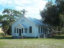
Miakka School House |
|
July 3, 1986
(#86001458) |
Miakka and Wilson Roads
27°19′10″N 82°16′11″W / 27.319444°N 82.269722°W / 27.319444; -82.269722 (Miakka School House) |
Miakka |
|
| 55 |
Municipal Auditorium-Recreation Club |
|
February 24, 1995
(#95000164) |
801 North Tamiami Trail
27°20′35″N 82°32′52″W / 27.343056°N 82.547778°W / 27.343056; -82.547778 (Municipal Auditorium-Recreation Club) |
Sarasota |
|
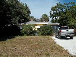
| 56 |
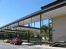
Lucienne Nielsen House |
|
March 21, 2007
(#07000163) |
3730 Sandspur Lane
27°10′27″N 82°29′39″W / 27.174167°N 82.494167°W / 27.174167; -82.494167 (Lucienne Nielsen House) |
Nokomis |
Part of the Sarasota School of Architecture MPS |
| 57 |
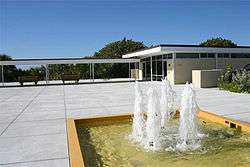
Nokomis Beach Pavilion |
|
May 28, 2013
(#13000320) |
100 Casey Key Rd.
27°07′28″N 82°28′13″W / 27.124511°N 82.470281°W / 27.124511; -82.470281 (Nokomis Beach Pavilion) |
Nokomis |
part of the Sarasota School of Architecture MPS |
| 58 |
John Nolen Plan of Venice Historic District |
|
November 8, 2010
(#10000840) |
Laguna Dr on N, Home Park Rd on E, the Corso on S, The Esplanade on W
27°05′46″N 82°26′35″W / 27.096111°N 82.443056°W / 27.096111; -82.443056 (John Nolen Plan of Venice Historic District) |
Venice |
|
| 59 |
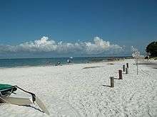
Osprey Archeological and Historic Site |
|
April 16, 1975
(#75000569) |
Address Restricted
27°12′N 82°29′W / 27.2°N 82.49°W / 27.2; -82.49 (Osprey Archeological and Historic Site) |
Osprey |
|
| 60 |
Osprey School |
|
July 15, 1994
(#94000707) |
337 North Tamiami Trail (U.S. Route 41)
27°12′05″N 82°29′29″W / 27.201389°N 82.491389°W / 27.201389; -82.491389 (Osprey School) |
Osprey |
|
| 61 |
Out of Door School |
|
October 28, 1994
(#94001276) |
444 Reid Street
27°17′09″N 82°33′38″W / 27.285833°N 82.560556°W / 27.285833; -82.560556 (Out of Door School) |
Sarasota |
|
| 62 |
Overtown Historic District |
|
July 19, 2002
(#02000781) |
Roughly along Central and Cohen Avenues between 9th and 4th Streets
27°22′13″N 82°32′35″W / 27.370278°N 82.543056°W / 27.370278; -82.543056 (Overtown Historic District) |
Sarasota |
|
| 63 |
Christy Payne Mansion |
|
September 25, 1998
(#98001201) |
800 South Palm Avenue
27°19′40″N 82°32′25″W / 27.327778°N 82.540278°W / 27.327778; -82.540278 (Christy Payne Mansion) |
Sarasota |
|
| 64 |
Capt. W. F. Purdy House |
|
March 22, 1984
(#84003840) |
3315 Bayshore Road
27°21′52″N 82°33′24″W / 27.364444°N 82.556667°W / 27.364444; -82.556667 (Capt. W. F. Purdy House) |
Sarasota |
Part of the Sarasota MRA |
| 65 |
L. D. Reagin House |
|
October 25, 1984
(#84000111) |
1213 North Palm Avenue
27°20′11″N 82°32′48″W / 27.336389°N 82.546667°W / 27.336389; -82.546667 (L. D. Reagin House) |
Sarasota |
Part of the Sarasota MRA |
| 66 |
Leonard Reid House |
|
October 29, 2002
(#02000780) |
1435 7th Street
27°20′38″N 82°32′30″W / 27.343889°N 82.541667°W / 27.343889; -82.541667 (Leonard Reid House) |
Sarasota |
|
| 67 |
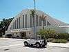
Revere Quality Institute House |
|
March 26, 2008
(#07001200) |
100 Ogden Lane
27°18′03″N 82°33′32″W / 27.300833°N 82.558889°W / 27.300833; -82.558889 (Revere Quality Institute House) |
Sarasota |
Part of the Sarasota School of Architecture MPS |
| 68 |
Rigby's La Plaza Historic District |
|
April 25, 1994
(#94000373) |
1002-1038 South Osprey Avenue, 1744 and 1776 Alta Vista Street, and 1777 Irving Avenue
27°19′27″N 82°32′04″W / 27.324167°N 82.534444°W / 27.324167; -82.534444 (Rigby's La Plaza Historic District) |
Sarasota |
|
| 69 |
Rosemary Cemetery |
|
November 16, 2003
(#03001143) |
851 Central Avenue
27°20′42″N 82°32′37″W / 27.345°N 82.543611°W / 27.345; -82.543611 (Rosemary Cemetery) |
Sarasota |
|
| 70 |
Roth Cigar Factory |
|
March 22, 1984
(#84003841) |
30 Mira Mar Court
27°20′04″N 82°32′27″W / 27.334444°N 82.540833°W / 27.334444; -82.540833 (Roth Cigar Factory) |
Sarasota |
Part of the Sarasota MRA |
| 71 |
Paul Rudolph Sarasota High School Addition |
|
June 27, 2012
(#12000365) |
1000 School Ave., S.
27°19′29″N 82°31′33″W / 27.324824°N 82.525831°W / 27.324824; -82.525831 (Paul Rudolph Sarasota High School Addition) |
Sarasota |
Part of the Sarasota School of Architecture MPS |
| 72 |
Sanderling Beach Club |
|
June 29, 1994
(#94000618) |
105 Beach Road
27°14′26″N 82°31′55″W / 27.240556°N 82.531944°W / 27.240556; -82.531944 (Sanderling Beach Club) |
Sarasota |
|
| 73 |
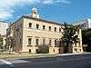
Sarasota County Courthouse |
|
March 22, 1984
(#84003842) |
2000 Main Street
27°20′08″N 82°31′50″W / 27.335556°N 82.530556°W / 27.335556; -82.530556 (Sarasota County Courthouse) |
Sarasota |
Part of the Sarasota MRA |
| 74 |
Sarasota Herald Building |
|
March 22, 1984
(#84003843) |
539 South Orange Avenue
27°19′53″N 82°32′19″W / 27.331389°N 82.538611°W / 27.331389; -82.538611 (Sarasota Herald Building) |
Sarasota |
Part of the Sarasota MRA |
| 75 |
Sarasota High School |
|
March 22, 1984
(#84003844) |
1001 South Tamiami Trail
27°19′30″N 82°31′46″W / 27.325°N 82.529444°W / 27.325; -82.529444 (Sarasota High School) |
Sarasota |
Part of the Sarasota MRA |
| 76 |
Sarasota Times Building |
|
March 22, 1984
(#84003845) |
1214-1216 1st Street
27°20′12″N 82°32′46″W / 27.336667°N 82.546111°W / 27.336667; -82.546111 (Sarasota Times Building) |
Sarasota |
Part of the Sarasota MRA |
| 77 |
Sarasota Woman's Club |
|
January 18, 1985
(#85000087) |
1241 North Palm Avenue
27°20′11″N 82°32′44″W / 27.336389°N 82.545556°W / 27.336389; -82.545556 (Sarasota Woman's Club) |
Sarasota |
Part of the Sarasota MRA |
| 78 |
George Schueler House |
|
September 26, 1997
(#97001170) |
76 South Washington Drive
27°19′04″N 82°34′25″W / 27.317778°N 82.573611°W / 27.317778; -82.573611 (George Schueler House) |
Sarasota |
|
| 79 |
Scott Commercial Building |
|
June 7, 2016
(#14001116) |
261-265 S. Orange Ave.
27°20′02″N 82°32′19″W / 27.333983°N 82.538616°W / 27.333983; -82.538616 (Scott Commercial Building) |
Sarasota |
Part of the Sarasota School of Architecture MPS |
| 80 |
South Side School |
|
September 14, 1984
(#84003846) |
1901 Webber Street
27°18′29″N 82°31′53″W / 27.308056°N 82.531389°W / 27.308056; -82.531389 (South Side School) |
Sarasota |
Part of the Sarasota MRA |
| 81 |
Southwick-Harmon House |
|
October 28, 2001
(#01001180) |
1830 Lincoln Drive
27°19′39″N 82°31′59″W / 27.3275°N 82.533056°W / 27.3275; -82.533056 (Southwick-Harmon House) |
Sarasota |
|
| 82 |
Thomas House |
|
July 1, 1994
(#94000666) |
5030 Bay Shore Road
27°22′38″N 82°33′36″W / 27.377222°N 82.56°W / 27.377222; -82.56 (Thomas House) |
Sarasota |
|
| 83 |
Triangle Inn |
|
February 23, 1996
(#96000175) |
351 South Nassau Street
27°05′42″N 82°26′52″W / 27.095°N 82.447778°W / 27.095; -82.447778 (Triangle Inn) |
Venice |
Part of the Venice MPS |
| 84 |
U.S. Post Office-Federal Building |
|
March 22, 1984
(#84003847) |
111 South Orange Avenue
27°20′09″N 82°32′19″W / 27.335833°N 82.538611°W / 27.335833; -82.538611 (U.S. Post Office-Federal Building) |
Sarasota |
Part of the Sarasota MRA |
| 85 |
Valencia Hotel and Arcade |
|
November 10, 1994
(#94001303) |
229 West Venice Avenue
27°05′58″N 82°26′50″W / 27.099444°N 82.447222°W / 27.099444; -82.447222 (Valencia Hotel and Arcade) |
Venice |
Part of the Venice MPS |
| 86 |
Venezia Park Historic District |
|
December 18, 1989
(#89002047) |
Roughly bounded by Palermo Street, Sorrento Street, South Harbor Drive, and Salerno Street
27°05′31″N 82°26′53″W / 27.091944°N 82.448056°W / 27.091944; -82.448056 (Venezia Park Historic District) |
Venice |
Part of the Venice MPS |
| 87 |
Venice Depot |
|
August 17, 1989
(#89001072) |
303 East Venice Avenue
27°06′02″N 82°26′25″W / 27.100556°N 82.440278°W / 27.100556; -82.440278 (Venice Depot) |
Venice |
Part of the Venice MPS |
| 88 |
Warm Mineral Springs |
|
November 28, 1977
(#77000408) |
12200 San Servando Ave.
27°03′35″N 82°15′38″W / 27.059722°N 82.260556°W / 27.059722; -82.260556 (Warm Mineral Springs) |
North Port |
|
| 89 |
Warm Mineral Springs Motel |
|
February 5, 2013
(#12001255) |
12597 South Tamiami Trail
27°02′51″N 82°15′43″W / 27.047603°N 82.261956°W / 27.047603; -82.261956 (Warm Mineral Springs Motel) |
North Port |
Part of the Sarasota School of Architecture MPS |
| 90 |
J. G. Whitfield Estate |
|
September 12, 1985
(#85002177) |
2704 Bayshore Drive
27°21′35″N 82°33′17″W / 27.359722°N 82.554722°W / 27.359722; -82.554722 (J. G. Whitfield Estate) |
Sarasota |
|
| 91 |
H. B. William House |
|
March 22, 1984
(#84003848) |
1509 South Orange Avenue
27°19′10″N 82°32′16″W / 27.319444°N 82.537778°W / 27.319444; -82.537778 (H. B. William House) |
Sarasota |
Part of the Sarasota MRA |
| 92 |
Dr. C. B. Wilson House |
|
March 22, 1984
(#84003849) |
235 South Orange Avenue
27°20′04″N 82°32′18″W / 27.334444°N 82.538333°W / 27.334444; -82.538333 (Dr. C. B. Wilson House) |
Sarasota |
Part of the Sarasota MRA |
| 93 |
Worth's Block |
|
June 3, 1998
(#98000651) |
1490 Main Street
27°20′09″N 82°32′27″W / 27.335833°N 82.540833°W / 27.335833; -82.540833 (Worth's Block) |
Sarasota |
|