Nampo Dam
| Nampo Dam | |
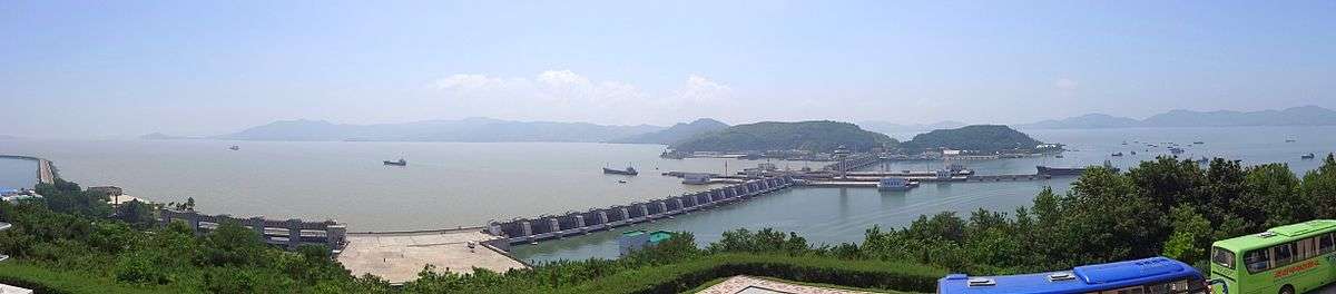
 Satellite photograph showing the West Sea Barrage. The Taedong River flows from right to left and the city of Nampho is on the north bank of the river in the center of the image. the West Sea Barrage is to the left, at the mouth of the river. | |
| Korean name | |
|---|---|
| Chosŏn'gŭl | 서해갑문 |
| Hancha | 西海閘門 |
| Revised Romanization | Seohae Gapmun |
| McCune–Reischauer | Sŏhae Kapmun |

The Nampho Dam or West Sea Dam, also known as the West Sea Barrage, is a tidal barrage located 15 km west of the special city of Nampho, North Korea. It is a large, eight-km-long system of dams, three lock chambers, and 36 sluices, allowing the passage of ships up to 50,000 tons. The dam closes the Taedong River off from the Yellow Sea. It was built from 1981 to 1986, with the resources of the whole country directed to this main construction project. The stated goal of the dam was:
- The prevention of seawater intrusion into the fresh water, thus solving the water supply problem;[1]
- The irrigation of additional land, enlarging the arable territory of the region.[2]
Foreign critics claim raising the Taedong river level has led to the loss of valuable farmland, contributing to the North Korean famine.
The dam is considered a major accomplishment of North Korea,[3] and is a commonly seen backdrop for North Korean television news broadcasts from Korean Central News Agency. It is also a popular stop for tour groups of international tourists, for whom there is a visitor centre on P'i Do Island where films are shown about the construction of the dam and the locks.
The locks are at geographical coordinates 38°40′31″N 125°10′35″E / 38.67528°N 125.17639°ECoordinates: 38°40′31″N 125°10′35″E / 38.67528°N 125.17639°E.
The dam's estimated total cost was US$4 billion.[4]
References
- ↑ "West Sea Barrage", TAEHA. "The Taedong River, before the barrage was built, could not be used for agriculture and industry because it would become salty by the rising tide."
- ↑ Democratic People´s Republic of Korea - Geography, climate and population, Food and Agriculture Organization of the United Nations, 2010, Retrieved 2011-05-03
- ↑ North Korea Archived 2011-08-06 at the Wayback Machine., Travel the Whole World, Retrieved 2011-05-03
- ↑ Oh, Kong Dan & Ralph C. Hassig. North Korea Through the Looking Glass, Brookings Institution Press, 2000, p53
External links
| Wikimedia Commons has media related to Nampo Dam. |
- Interactive Virtual Tour of Nampo Dam
- Kristof, Nicholas D. (5 July 1989). "In North Korea, Dam Reflects 'Great Leader's' State of Mind". The New York Times.
- North Korean propaganda film on the West Sea Barrage, via YouTube: Part 1, 2, 3