M'tsamoudou
| M'tsamoudou | |
|---|---|
| Village | |
 M'tsamoudou | |
|
M'tsamoudou | |
| Coordinates: 12°54′33″S 45°11′40″E / 12.90917°S 45.19444°ECoordinates: 12°54′33″S 45°11′40″E / 12.90917°S 45.19444°E | |
| Country |
|
| Overseas Territory | Mayotte |
| Commune | Bandrele |
| Area | |
| • Total | 3.646 km2 (1.408 sq mi) |
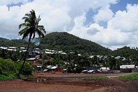
M'tsamoudou is a village in the commune of Bandrele on Mayotte. It is located on the south east coast, north east of the village of Dapani. It has a notable beach. The village covers an area of 3646 hectares. The current mayor of Dapani is Moussa Madi.[1]
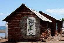
Local houses
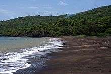
M'tsamoudou beach
References
- ↑ "Mtsamoudou" (in French). Malango Mayotte. Retrieved September 6, 2009.
This article is issued from
Wikipedia.
The text is licensed under Creative Commons - Attribution - Sharealike.
Additional terms may apply for the media files.