Mount Zeppelin
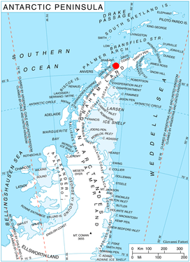
Location of Pefaur (Ventimiglia) Peninsula on Danco Coast, Antarctic Peninsula.
Mount Zeppelin (64°27′S 61°31′W / 64.450°S 61.517°WCoordinates: 64°27′S 61°31′W / 64.450°S 61.517°W) is a mountain, 1,265 m, standing 3 miles (4.8 km) southeast of Eckener Point on Pefaur (Ventimiglia) Peninsula, Danco Coast on the west coast of Graham Land. Charted by the Belgian Antarctic Expedition under Gerlache, 1897-99. Named by the United Kingdom Antarctic Place-Names Committee (UK-APC) in 1960 for Count Ferdinand von Zeppelin (1838-1917), German aeronautical engineer who perfected the large-scale rigid airship, 1894-1917.
Map
- British Antarctic Territory. Scale 1:200000 topographic map. DOS 610 Series, Sheet W 64 60. Directorate of Overseas Surveys, Tolworth, UK, 1978.
References
![]()
This article is issued from
Wikipedia.
The text is licensed under Creative Commons - Attribution - Sharealike.
Additional terms may apply for the media files.