Mount Yufu
| Mount Yufu | |
|---|---|
| 由布岳 | |
 SW side | |
| Highest point | |
| Elevation | 1,583.3 m (5,195 ft) |
| Listing | List of mountains and hills of Japan by height |
| Coordinates | 33°16′56″N 131°23′24″E / 33.28222°N 131.39000°E |
| Naming | |
| Pronunciation | [juɸudake] |
| Geography | |
| Location | On the border of Yufu and Beppu, Ōita, Japan |
| Topo map | Geographical Survey Institute 25000:1 別府西 |
| Geology | |
| Mountain type | Stratovolcano |
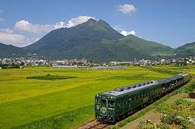
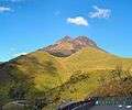
Mount Yufu (由布岳 Yufudake) is a 1,583.3 m (5,195 ft) volcano, located on the border of Yufu and Beppu, Ōita, Japan.
Outline
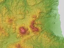
Relief map of Yufu Volcano (Left) & Tsurumi Volcano (Center)
Mount Yufu is a stratovolcano. It has two peaks, called ‘Higashi-mine’ (East Peak) and ‘Nishi-mine’ (West Peak). Nishi-mine is about one meter higher than Higashi-Mine.
Route
The most popular route is from Yufu Tozanguchi Bus Stop of Kamenoi Bus. It takes two and half hours. There are other routes from Yufu City and Higashi Tozanguchi Bus Stop.
Gallery
 SSW side
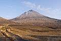 S side
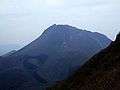 Viewed from Mt. Tsurumi
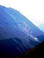 Collapsed section
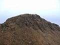 West Peak
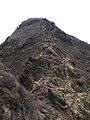 East Peak
 The summit
References
External links
| Wikimedia Commons has media related to Mount Yufu. |
- Yufudake - Japan Meteorological Agency (in Japanese)
- Yufudake: National catalogue of the active volcanoes in Japan - Japan Meteorological Agency
- Yufu Dake - Geological Survey of Japan
- Yufu-Tsurumi: Global Volcanism Program - Smithsonian Institution
This article is issued from
Wikipedia.
The text is licensed under Creative Commons - Attribution - Sharealike.
Additional terms may apply for the media files.