Tavurvur
| Tavurvur | |
|---|---|
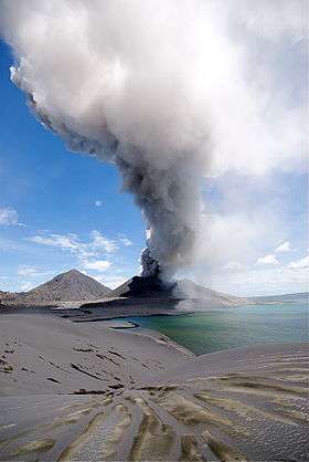 Tavurvur erupting | |
| Highest point | |
| Elevation | 224 m (735 ft) |
| Coordinates | 4°14′20″S 152°12′36″E / 4.239°S 152.21°ECoordinates: 4°14′20″S 152°12′36″E / 4.239°S 152.21°E |
| Geography | |
 Tavurvur | |
| Geology | |
| Mountain type | Cinder Cone volcano, vent of Rabaul caldera |
| Last eruption | August to September 2014 |
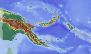
Tavurvur is an active stratovolcano near Rabaul, on the island of New Britain, in Papua New Guinea. It is a sub-vent of the Rabaul caldera[1] and lies on the eastern rim of the larger feature. An eruption of the volcano largely destroyed the nearby town of Rabaul in 1994.
Mount Tavurvur is the most active volcano in Rabaul caldera, and erupted most recently on 12 September 2014.[2]
The correct pronunciation of the volcano's name is tah-VOOR-voor, according to the Rabaul Volcanological Observatory.
History
Gallery
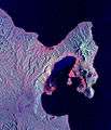 Space Radar Image of Rabaul Volcano
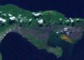 Tavurvur from Low Earth orbit
 Tavurvur's 2009 eruption
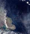 Ash plume from Tavurvur
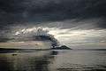
References
- ↑ "Rabaul". Global Volcanism Program. Smithsonian Institution. Retrieved 2014-08-30.
- ↑ "Rabaul (Tavurvur) volcano (New Britain, Papua New Guinea) activity update". volcanodiscovery.com. 2014-09-12. Retrieved 2014-11-11.
External links
| Wikimedia Commons has media related to Rabaul caldera. |
- Volcano World: Tavurvur, Rabaul Caldera
- Volcano Eruption in Papua New Guinea on YouTube, the August 29th, 2014 eruption of Tavurvur captured by Phil McNamara.
This article is issued from
Wikipedia.
The text is licensed under Creative Commons - Attribution - Sharealike.
Additional terms may apply for the media files.