Rumija
| Rumija | |
|---|---|
|
Rumija | |
 | |
| Highest point | |
| Elevation | 1,594 m (5,230 ft) |
| Prominence | 1,500 m (4,900 ft) |
| Coordinates | 42°6′10″N 19°11′37″E / 42.10278°N 19.19361°ECoordinates: 42°6′10″N 19°11′37″E / 42.10278°N 19.19361°E |
| Geography | |
 Rumija Location in Montenegro | |
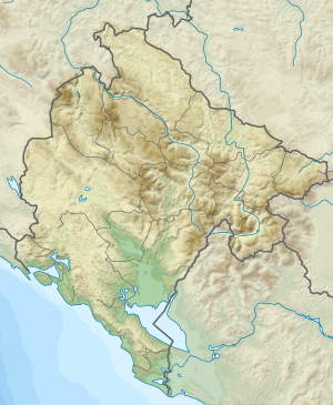
| Location | southern Montenegro |
| Parent range | Dinaric Alps |
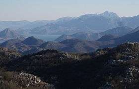
Rumija (Serbian Cyrillic: Румија) is a mountain in southern Montenegro, situated between the Adriatic and Lake Skadar. The highest point is Rumija, which is 1,594 m (5,230 ft) high. Rumija rises above the town of Bar, and is a natural Dinaric barrier, separating the Adriatic from the Skadar basin. It is the southernmost mountain of Montenegro, and with prominence of 1,500 m (4,921 ft), one of the most prominent.
References
External links
| Wikimedia Commons has media related to Rumija. |
This article is issued from
Wikipedia.
The text is licensed under Creative Commons - Attribution - Sharealike.
Additional terms may apply for the media files.