Mount Hongū
| Mount Hongū | |
|---|---|
| 本宮山 | |
.JPG) Mount Hongū seen from Mount Ishimaki | |
| Highest point | |
| Elevation | 789.2 m (2,589 ft) |
| Geography | |
| Location | Toyokawa, Okazaki, Shinshiro in Aichi Prefecture, Japan |
| Climbing | |
| Easiest route | by car or hiking |
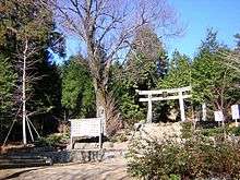
Torii
Mount Hongū (本宮山 Hongū-san) is a mountain located on the border of three cities in Aichi Prefecture, Toyokawa, Okazaki, and Shinshiro.
| Wikimedia Commons has media related to Mount Hongū. |
Coordinates: 34°54′35″N 137°25′14″E / 34.90972°N 137.42056°E
This article is issued from
Wikipedia.
The text is licensed under Creative Commons - Attribution - Sharealike.
Additional terms may apply for the media files.