Mouloud
| Mouloud مولود | |
|---|---|
| Town | |
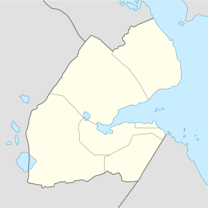 Mouloud مولود Location in Djibouti | |
| Coordinates: 11°09′00″N 42°30′00″E / 11.15000°N 42.50000°E | |
| Country |
|
| Region | Dikhil |
| Elevation | 590 m (1,940 ft) |
| Population | |
| • Total | 10,000 |
Mouloud (Arabic: مولود) is a town located in the southern Dikhil region of Djibouti. It is located around 102 kilometers south of the capital, Djibouti City.
Overview
It lies on the National Highway 1.
Nearby towns and villages include Djibouti City, Dikhil and Galafi.
Demographics
As of 2012, the population of Mouloud has been estimated to be 460. The town's inhabitants belong to various mainly Afro-Asiatic-speaking ethnic groups, with the Issa Somali predominant.
Climate
The warmest month of the year is June with an average temperature of 33.5 °C. In January, the average temperature is 22.8 °C. It is the lowest average temperature of the whole year and the driest month is December with 4 mm. Most precipitation falls in August, with an average of 38 mm.
| Climate data for Mouloud | |||||||||||||
|---|---|---|---|---|---|---|---|---|---|---|---|---|---|
| Month | Jan | Feb | Mar | Apr | May | Jun | Jul | Aug | Sep | Oct | Nov | Dec | Year |
| Average high °C (°F) | 27.7 (81.9) |
28.0 (82.4) |
30.0 (86) |
32.6 (90.7) |
35.9 (96.6) |
38.8 (101.8) |
38.1 (100.6) |
37.0 (98.6) |
35.8 (96.4) |
32.7 (90.9) |
29.7 (85.5) |
28.1 (82.6) |
32.9 (91.2) |
| Average low °C (°F) | 17.8 (64) |
19.5 (67.1) |
21.1 (70) |
23.4 (74.1) |
26.0 (78.8) |
28.4 (83.1) |
26.3 (79.3) |
25.8 (78.4) |
26.7 (80.1) |
22.7 (72.9) |
19.8 (67.6) |
18.2 (64.8) |
23 (73.4) |
| Average rainfall mm (inches) | 7 (0.28) |
9 (0.35) |
11 (0.43) |
31 (1.22) |
15 (0.59) |
5 (0.2) |
6 (0.24) |
41 (1.61) |
27 (1.06) |
15 (0.59) |
9 (0.35) |
8 (0.31) |
184 (7.23) |
| Source: The Weather Channel | |||||||||||||
References
This article is issued from
Wikipedia.
The text is licensed under Creative Commons - Attribution - Sharealike.
Additional terms may apply for the media files.