Monti Trebulani
| Monti Trebulani | |
|---|---|
|
Colli Caprensi | |
| Highest point | |
| Peak | Monte Maggiore |
| Elevation | 1,036 m (3,399 ft) |
| Coordinates | 41°11′N 14°16′E / 41.183°N 14.267°E |
| Geography | |
| Country | Italy |
| State/Province | Campania |
| District | Caserta |
| Range coordinates | 41°11′N 14°16′E / 41.183°N 14.267°ECoordinates: 41°11′N 14°16′E / 41.183°N 14.267°E |
| Parent range | Apennine Mountains |
| Geology | |
| Orogeny | Southern Apenninic Orogeny |
The Monti Trebulani or Colli Caprensi is a mountain range in the province of Caserta, Campania, southern Italy.
They take their name from the ancient city of Trebula Balliensis, a Roman colony founded in the 3rd-2nd century BC, whose remains are in the frazione Treglia of the comune of Pontelatone.
The range has a length of some 20 km, from north to south, starting from the territory of Pietravairano to Bellona.
Sights include the grotto of San Michele, in the comune of Liberi.
See also
| Provinces | 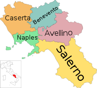 | |
|---|---|---|
| Places |
| |
| History | ||
| Politics and government | ||
Categories | ||
This article is issued from
Wikipedia.
The text is licensed under Creative Commons - Attribution - Sharealike.
Additional terms may apply for the media files.