Montejurra
| Montejurra | |
|---|---|
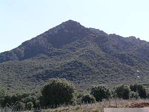 View of Montejurra from the Monastery of Irache | |
| Highest point | |
| Elevation | 1,042 m (3,419 ft) |
| Coordinates | 42°37′52″N 02°02′41″W / 42.63111°N 2.04472°WCoordinates: 42°37′52″N 02°02′41″W / 42.63111°N 2.04472°W |
| Geography | |
 Montejurra Location in Spain | |
| Location | Navarre, Spain |
| Parent range | Basque Mountains |
Montejurra in Spanish and Jurramendi in Basque are the names of a mountain in Navarre region (Spain). Each year, it hosts a Carlist celebration in remembrance of the 1873 Battle of Montejurra during the Third Carlist War. In 2004, approximately 1,000 persons turned out.
Between 1960 and 1971 the Carlists were publishing a monthly magazine named Montejurra.
On 9 May 1976 during the Spanish Transition, far right-wing gunmen supported by the Spanish secret services, killed two people at the Carlist Party celebration at a time when it was drifting toward left-leaning positions. This became known as the Montejurra Incidents.
External links
| Wikimedia Commons has media related to Montejurra. |
This article is issued from
Wikipedia.
The text is licensed under Creative Commons - Attribution - Sharealike.
Additional terms may apply for the media files.