Monte Stella (Cilento)
| Stella | |
|---|---|
 | |
| Highest point | |
| Elevation | 1,131 m (3,711 ft) |
| Coordinates | 40°14′14.65″N 15°3′58.6″E / 40.2374028°N 15.066278°ECoordinates: 40°14′14.65″N 15°3′58.6″E / 40.2374028°N 15.066278°E |
| Geography | |
 Stella Location in Italy | |
| Location | Province of Salerno (Campania, Italy) |
| Parent range | Lucan Subappennines |
Monte Stella is a mountain the Lucan Subappennines, with an elevation of 1,131 m, located in Cilento, Campania, southern Italy.
Geography
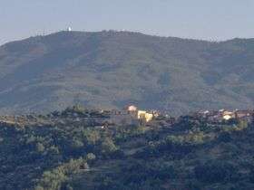
At his slopes there are located the villages of Serramezzana, San Mauro Cilento, Galdo (hamlet of Pollica), Amalafede, San Giovanni, Guarrazzano, Stella Cilento, Omignano, Sessa Cilento, Castagneto, San Mango Cilento, Mercato Cilento and Perdifumo.
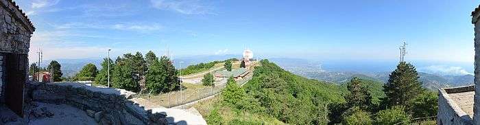
On the summit is a radar station and the "Madonna del Monte Stella" church.
Pictures
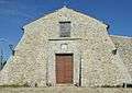 The church from the front
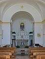 Inside the church
See also
References
External links
![]()
This article is issued from
Wikipedia.
The text is licensed under Creative Commons - Attribution - Sharealike.
Additional terms may apply for the media files.