Mont Sokbaro
| Mont Sokbaro | |
|---|---|
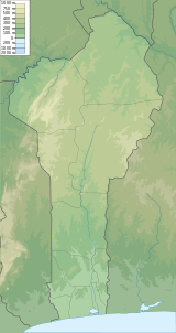 Mont Sokbaro Location in Benin (on the border with Togo) | |
| Highest point | |
| Elevation | 658 m (2,159 ft) |
| Coordinates | 9°19′41″N 1°24′56″E / 9.32806°N 1.41556°ECoordinates: 9°19′41″N 1°24′56″E / 9.32806°N 1.41556°E |
| Geography | |
| Location | Benin - Togo border |
| Geology | |
| Mountain type | Hill |
Mont Sokbaro is cited by some sources as the highest point of Benin, with an altitude of 658 metres (2,159 ft). It is located on the border between Benin and Togo, part of the Atakora Mountains. Other locations such as 2.5 km southeast of Kotoponga at 10-17-22N 1-32-38E have SRTM readings of 670 meters.
See also
External links
- (in English) Mont Sokbaro, Togo, Geonames.org
This article is issued from
Wikipedia.
The text is licensed under Creative Commons - Attribution - Sharealike.
Additional terms may apply for the media files.