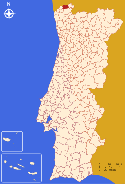
Monção
| Monção | |||
|---|---|---|---|
| Municipality | |||
| |||
 | |||
| Coordinates: 42°04′35″N 8°28′55″W / 42.07639°N 8.48194°WCoordinates: 42°04′35″N 8°28′55″W / 42.07639°N 8.48194°W | |||
| Country |
| ||
| Region | Norte | ||
| Subregion | Minho-Lima | ||
| Intermunic. comm. | Alto Minho | ||
| District | Viana do Castelo | ||
| Government | |||
| • President | José Moreira (Socialist) | ||
| Area | |||
| • Total | 211.31 km2 (81.59 sq mi) | ||
| Population (2011) | |||
| • Total | 19,230 | ||
| • Density | 91/km2 (240/sq mi) | ||
| Time zone | WET/WEST (UTC+0/+1) | ||
| Website |
www | ||


Monção (Portuguese pronunciation: [mõˈsɐ̃w]) is a municipality in the district of Viana do Castelo in Portugal. The population in 2011 was 19,230,[1] in an area of 211.31 km².[2] The current Mayor is Socialist Party's José Emílio Pedreira Moreira. The municipal holiday is March 12.
Notable people
- José Gomes Temporão, Minister of Health of Brazil
- Fernando Vilar, Uruguayan newsanchor
- Melanie Fernandes, Valdemar Fernandes' granddaughter
Population
| Population of Monção Municipality (1801–2011) | ||||||||
|---|---|---|---|---|---|---|---|---|
| 1801 | 1849 | 1900 | 1930 | 1960 | 1981 | 1991 | 2001 | 2011 |
| 12,095 | 14,983 | 26,077 | 24,585 | 27,393 | 23,799 | 21,799 | 19,956 | 19,230 |
Parishes
Administratively, the municipality is divided into 24 civil parishes (freguesias):[3]
- Abedim
- Anhões e Luzio
- Barbeita
- Barroças e Taias
- Bela
- Cambeses
- Ceivães e Badim
- Lara
- Longos Vales
- Mazedo e Cortes
- Merufe
- Messegães, Valadares e Sá
- Monção e Troviscoso
- Moreira
- Pias
- Pinheiros
- Podame
- Portela
- Riba de Mouro
- Sago, Lordelo e Parada
- Segude
- Tangil
- Troporiz e Lapela
- Trute
See also
References
- ↑ Instituto Nacional de Estatística
- ↑ Direção-Geral do Território Archived 2014-09-29 at Archive.is
- ↑ Diário da República. "Law nr. 11-A/2013, pages 552 75-76" (pdf) (in Portuguese). Retrieved 28 July 2014.
External links
This article is issued from
Wikipedia.
The text is licensed under Creative Commons - Attribution - Sharealike.
Additional terms may apply for the media files.