Misk'a Urqu
| Misk'a Urqu | |
|---|---|
 Misk'a Urqu Location within Bolivia | |
| Highest point | |
| Elevation | 3,260 m (10,700 ft) [1] |
| Coordinates | 19°11′34″S 65°20′56″W / 19.19278°S 65.34889°WCoordinates: 19°11′34″S 65°20′56″W / 19.19278°S 65.34889°W |
| Geography | |
| Location |
Bolivia, Chuquisaca Department |
| Parent range | Andes |
Misk'a Urqu (Quechua misk'ay to stumble, urqu mountain,[2] also spelled Mizkha Orkho) is a mountain in the Bolivian Andes which reaches a height of approximately 3,260 m (10,700 ft). It is located in the Chuquisaca Department, Oropeza Province, Yotala Municipality. Misk'a Urqu lies southeast of Chullpa Urqu. The Misk'a River (Quechua: Misk'a Mayu) originates east of the mountain. Its waters flow to the Pillku Mayu (Quechua for "red river").[1][3]
References
Capital: Sucre | ||
| Provinces | 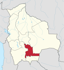 | |
| Municipalities and seats |
| |
This article is issued from
Wikipedia.
The text is licensed under Creative Commons - Attribution - Sharealike.
Additional terms may apply for the media files.