Merrygoen
| Merrygoen New South Wales | |
|---|---|
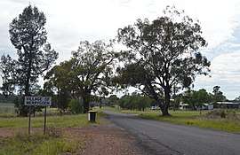 Entering Merrygoen, 2017 | |
|
Merrygoen | |
| Coordinates | 31°49′S 149°14′E / 31.817°S 149.233°ECoordinates: 31°49′S 149°14′E / 31.817°S 149.233°E |
| Population | 115 (2016 census)[1] |
| Postcode(s) | 2831 |
| LGA(s) | Warrumbungle Shire |
| State electorate(s) | Barwon |
| Federal Division(s) | Parkes |
Merrygoen is a small township in north-western New South Wales, Australia. The town is a junction point between railway lines to Troy Junction on the Coonamble railway line, and the Gwabegar railway line. The railway station is now closed however wheat silos and several sidings remain in use. [2] Merrygoen is in the Gap to Dubbo section of the Intrastate Network managed by the Australian Rail Track Corporation[3].
Merrygoen Post Office opened on 1 November 1879.[4]
References
- ↑ Australian Bureau of Statistics (27 June 2017). "Merrygoen (State Suburb)". 2016 Census QuickStats. Retrieved 18 March 2018.

- ↑ "Merrygoen station". NSWRail.net. Retrieved 2010-04-09.
- ↑ "ARTC Intrastate Network". Australian Rail Track Corporation. Retrieved 2018-02-18.
- ↑ Premier Postal History. "Post Office List". Premier Postal Auctions. Retrieved 2011-05-26.
External links
![]()
| Preceding station | NSW Branch lines | Following station | ||
|---|---|---|---|---|
towards Gwabegar | Gwabegar Line | Wongoni towards Wallerawang |
||
| Preceding station | NSW Branch lines | Following station | ||
Boothenba towards Troy Junction | Troy Junction – Merrygoen Line | Terminus |
This article is issued from
Wikipedia.
The text is licensed under Creative Commons - Attribution - Sharealike.
Additional terms may apply for the media files.