Mazorakopf
| Mazorakopf | |
|---|---|
| Falknishorn | |
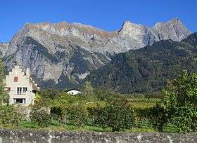 Mazorakopf (left) viewed from the Swiss side | |
| Highest point | |
| Elevation | 2,451.5 m (8,043 ft) |
| Isolation | 0.2 kilometres (0.12 mi) |
| Coordinates | 47°02′54.52″N 9°33′25.17″E / 47.0484778°N 9.5569917°ECoordinates: 47°02′54.52″N 9°33′25.17″E / 47.0484778°N 9.5569917°E |
| Geography | |
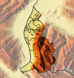 Mazorakopf Location in Liechtenstein, on the border with Switzerland | |
| Location | Liechtenstein / Switzerland |
| Parent range | Rätikon |
Mazorakopf or Falknishorn (2451.5 m) is a mountain on the border between Switzerland and Liechtenstein. It is the southernmost point of the principality of Liechtenstein.
This article is issued from
Wikipedia.
The text is licensed under Creative Commons - Attribution - Sharealike.
Additional terms may apply for the media files.