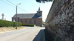
Marchovelette
| Marchovelette | |
|---|---|
| Village | |
 | |
 Marchovelette Location in Belgium | |
| Coordinates: 50°31′N 04°56′E / 50.517°N 4.933°ECoordinates: 50°31′N 04°56′E / 50.517°N 4.933°E | |
| Country |
|
| Region |
|
| Community |
|
| Province |
|
| Municipality | Fernelmont |
| Area | |
| • Total | 5.01 km2 (1.93 sq mi) |
| Elevation | 187 m (614 ft) |
| Population (1 January 2017) | |
| • Total | 798 |
| • Density | 160/km2 (410/sq mi) |
| Website |
fernelmont |
Marchovelette (Walloon: Måtchovlete) is a section of the Belgian municipality of Fernelmont located in Wallonia in the province Namur.
It was formerly a municipality itself until the fusion of Belgian municipalities in 1977.
External links

- Website of Fernelmont (French)
This article is issued from
Wikipedia.
The text is licensed under Creative Commons - Attribution - Sharealike.
Additional terms may apply for the media files.