Index map
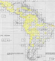
Index maps are a type of finding aid that allow users find a set of maps covering their regions of interest along with the name or number of the relevant map sheet. An index map provides geospatial data on either a sheet of paper or a computer screen. In this way, a map acts as a kind of gazetteer, with the location (such as a call number) represented within a grid overlaying the maps surface.[1]
One important reason for this geospatial data is because political borders often change. Information is searched by coordinates, rather than the metadata for a particular country and region that can be entered into a catalog. Additionally, in various institutions, maps are sometimes cataloged individually or as sets, resulting in various levels of specificity.
References
- ↑ Jensen, K.L. (June 2004), "Index maps for the digital age", Information Technology and Libraries, 23 (2): 81–7