Manokotak, Alaska
| Manokotak Manuquutaq | |
|---|---|
| City | |
 Manokotak Location in Alaska | |
| Coordinates: 58°58′52″N 159°3′21″W / 58.98111°N 159.05583°W | |
| Country | United States |
| State | Alaska |
| Census Area | Dillingham |
| Incorporated | October 19, 1970[1] |
| Government | |
| • Mayor | Melvin Andrew[2] |
| • State senator | Lyman Hoffman (D) |
| • State rep. | Bryce Edgmon (D) |
| Area[3] | |
| • Total | 37.14 sq mi (96.19 km2) |
| • Land | 35.73 sq mi (92.55 km2) |
| • Water | 1.41 sq mi (3.64 km2) |
| Elevation | 16 ft (5 m) |
| Population (2010) | |
| • Total | 442 |
| • Estimate (2016)[4] | 447 |
| • Density | 12.04/sq mi (4.65/km2) |
| Time zone | UTC-9 (Alaska (AKST)) |
| • Summer (DST) | UTC-8 (AKDT) |
| ZIP code | 99628 |
| Area code | 907 |
| FIPS code | 02-46890 |
Manokotak (Manuquutaq in Central Alaskan Yup'ik) is a city in Dillingham Census Area, Alaska, United States. At the 2010 census the population was 442,[5] up from 399 in 2000.
Geography
Manokotak is located at 58°58′52″N 159°3′21″W / 58.98111°N 159.05583°W (58.981087, -159.055808).[6]
According to the United States Census Bureau, the city has a total area of 37.1 square miles (96.2 km2), of which 35.8 square miles (92.6 km2) is land and 1.4 square miles (3.6 km2), or 3.79%, is water.[5]
Demographics
| Historical population | |||
|---|---|---|---|
| Census | Pop. | %± | |
| 1950 | 120 | — | |
| 1960 | 149 | 24.2% | |
| 1970 | 214 | 43.6% | |
| 1980 | 294 | 37.4% | |
| 1990 | 385 | 31.0% | |
| 2000 | 399 | 3.6% | |
| 2010 | 442 | 10.8% | |
| Est. 2016 | 447 | [4] | 1.1% |
| U.S. Decennial Census[7] | |||
Manokotak first appeared on the 1950 U.S. Census as an unincorporated village. It formally incorporated in 1970.
As of the census[8] of 2000, there were 399 people, 93 households, and 77 families residing in the village. The population density was 11.0 people per square mile (4.2/km²). There were 106 housing units at an average density of 2.9 per square mile (1.1/km²). The racial makeup of the city was 4.76% White, 0.25% Black or African American, 94.74% Native American, and 0.25% from two or more races.
There were 93 households out of which 55.9% had children under the age of 18 living with them, 67.7% were married couples living together, 11.8% had a female householder with no husband present, and 17.2% were non-families. 15.1% of all households were made up of individuals and none had someone living alone who was 65 years of age or older. The average household size was 4.29 and the average family size was 4.92.
In the village the age distribution of the population shows 44.4% under the age of 18, 10.8% from 18 to 24, 24.8% from 25 to 44, 15.0% from 45 to 64, and 5.0% who were 65 years of age or older. The median age was 22 years. For every 100 females, there were 116.8 males. For every 100 females age 18 and over, there were 133.7 males.
The median income for a household in the village was $26,875, and the median income for a family was $30,357. Males had a median income of $13,125 versus $0 for females. The per capita income for the city was $9,294. About 32.5% of families and 35.3% of the population were below the poverty line, including 44.0% of those under age 18 and none of those age 65 or over.
Notable residents
Village Public Safety Officer (VPSO) Thomas O. Madole, murdered in the line of duty by Manokotak resident Leroy B. Dick, Jr.[9][10] The murder of Officer Madole led to significant changes in Alaska's VPSO program, including the passage of legislation to allow VPSOs to carry firearms.[11]
Education
The Manokotak "Nunaniq" School of the Southwest Region School District serves the village.[12]
References
- ↑ 1996 Alaska Municipal Officials Directory. Juneau: Alaska Municipal League/Alaska Department of Community and Regional Affairs. January 1996. p. 93.
- ↑ 2015 Alaska Municipal Officials Directory. Juneau: Alaska Municipal League. 2015. p. 99.
- ↑ "2016 U.S. Gazetteer Files". United States Census Bureau. Retrieved Jun 22, 2017.
- 1 2 "Population and Housing Unit Estimates". Retrieved June 9, 2017.
- 1 2 "Geographic Identifiers: 2010 Demographic Profile Data (G001): Manokotak city, Alaska". U.S. Census Bureau, American Factfinder. Retrieved October 9, 2015.
- ↑ "US Gazetteer files: 2010, 2000, and 1990". United States Census Bureau. 2011-02-12. Retrieved 2011-04-23.
- ↑ "Census of Population and Housing". Census.gov. Retrieved June 4, 2015.
- ↑ "American FactFinder". United States Census Bureau. Retrieved 2008-01-31.
- ↑ http://www.thebristolbaytimes.com/article/1509dick_gets_99_years_for_murder_of_vpso
- ↑ http://www.adn.com/article/20130320/killed-vpso-officer-manokotak-mourned-irreplaceable
- ↑ http://www.housemajority.org/2014/07/18/governor-signs-edgmon-bill-to-allow-arming-of-vpsos/
- ↑ "Manokotak." Southwest Region School District. Retrieved on March 26, 2017.
Coordinates: 58°58′52″N 159°03′21″W / 58.981087°N 159.055808°W
Municipalities and communities of Dillingham Census Area, Alaska, United States | ||
|---|---|---|
| Cities | 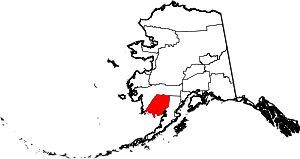 | |
| CDPs | ||
| Unincorporated communities | ||