Mangaldoi
| Mangaldai | |
|---|---|
| City in India | |
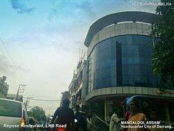 View of Mangaldoi Repose building in LNB Road(The Heart of Mangaldai) | |
 Mangaldai Location in Assam, India  Mangaldai Mangaldai (India) | |
| Coordinates: 26°26′N 92°02′E / 26.43°N 92.03°ECoordinates: 26°26′N 92°02′E / 26.43°N 92.03°E | |
| Country |
|
| State | Assam |
| District | Darrang |
| Founded by | Government of Assam |
| Government | |
| • Body | Mangaldoi Municipality Board |
| Elevation | 34 m (112 ft) |
| Population (2011) | |
| • Total | 42,946 |
| Languages | |
| • Official | Assamese |
| Time zone | UTC+5:30 (IST) |
| PIN | 784125(East,West and South),784529(North) |
| Vehicle registration | AS- 13**** |
| Sex ratio | 923:1000 ♂/♀ |
| Website |
darrang |
Mangaldai, /ˈmæŋɡəlˌdɔɪ/; also spelt Mangaldoi) is a city in the Indian state of Assam. It was named after Mangaldahi, who was the daughter of the Rajah of Darrang and was married to Pratap Singha, a ruler of the Ahom kingdom. Mangaldoi serves as the administrative headquarters of Darrang district.
Geography
Mangaldoi is located at 26°26′N 92°02′E / 26.43°N 92.03°E.[1] It has an average elevation of 34 m (112 ft).
Situated at the north bank of Brahmaputra river, the city is approximately 65 km from Guwahati and 90 km from Tezpur.
Demographics
As of 2011 India census,[2] Mangaldoi had a population of 42,946. Males constituted 52% of the population and females 48%. Mangaldoi had an average literacy rate of 91%, higher than the national average of 59.5%: male literacy was 92%, and female literacy was 90%. In Mangaldoi, 11% of the population was below 6 years of age .The population is largely of heterogeneous nature. Assamese, Bengali, Marwardi,Bihari,Punjabi communities form the majority.
Governance
Mangaldoi is part of Mangaldoi (Lok Sabha constituency).[3]
Gurujyoti Das of BJP is the present MLA of Mangaldoi. Ramen Deka of BJP is the present MP of Mangaldoi.
References
- ↑ Falling Rain Genomics, Inc - Mangaldoi
- ↑ "Census of India 2001: Data from the 2001 Census, including cities, villages and towns (Provisional)". Census Commission of India. Archived from the original on 2004-06-16. Retrieved 2008-11-01.
- ↑ "List of Parliamentary & Assembly Constituencies" (PDF). Assam. Election Commission of India. Archived from the original (PDF) on 2006-05-04. Retrieved 2008-10-06.