Majors Place, Nevada
| Majors Place, Nevada | |
|---|---|
| Unincorporated community | |
 | |
| Nickname(s): Used to be known as Major Wood's, named for the owner and operator. | |
 Majors Place Location within the state of Nevada | |
| Coordinates: 39°01′30″N 114°34′55″W / 39.02500°N 114.58194°W | |
| Country | United States |
| State | Nevada |
| County | White Pine |
| Elevation | 6,490 ft (1,980 m) |
| Time zone | UTC-8 (Pacific (PST)) |
| • Summer (DST) | UTC-7 (PDT) |
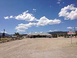
Majors Place is an unincorporated community in White Pine County, Nevada. It is at the junction of U.S. Route 6, U.S. Route 50 and U.S. Route 93. It includes a bar, restaurant, two hotel rooms, and an RV park. Fuel is no longer available.
Coordinates: 39°01′30″N 114°34′55″W / 39.02500°N 114.58194°W
| Wikimedia Commons has media related to Majors Place, Nevada. |
This article is issued from
Wikipedia.
The text is licensed under Creative Commons - Attribution - Sharealike.
Additional terms may apply for the media files.