Madgoul, Djibouti
| Madgoul مدغول | |
|---|---|
| Town | |
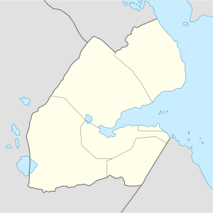 Madgoul مدغول Location in Djibouti | |
| Coordinates: 12°21′46″N 42°27′54″E / 12.36278°N 42.46500°ECoordinates: 12°21′46″N 42°27′54″E / 12.36278°N 42.46500°E | |
| Country |
|
| Region | Tadjourah |
| Elevation | 307 m (1,007 ft) |
Madgoul (Arabic: مدغول), also known as Madgul, is a town in the northern of Tadjoura Region. It is situated about 74 kilometres (46 miles) north of Tadjoura and 14 km (8 mi) east of the border with Ethiopia.
Climate
Madgoul has a hot desert climate (BWh) in Köppen-Geiger system.
| Climate data for Madgoul | |||||||||||||
|---|---|---|---|---|---|---|---|---|---|---|---|---|---|
| Month | Jan | Feb | Mar | Apr | May | Jun | Jul | Aug | Sep | Oct | Nov | Dec | Year |
| Average high °C (°F) | 28.0 (82.4) |
28.7 (83.7) |
30.6 (87.1) |
32.7 (90.9) |
35.8 (96.4) |
38.7 (101.7) |
39.2 (102.6) |
38.3 (100.9) |
36.6 (97.9) |
33.3 (91.9) |
30.5 (86.9) |
28.6 (83.5) |
33.4 (92.2) |
| Average low °C (°F) | 20.0 (68) |
21.0 (69.8) |
22.3 (72.1) |
24.1 (75.4) |
26.4 (79.5) |
29.1 (84.4) |
28.6 (83.5) |
28.0 (82.4) |
28.0 (82.4) |
24.3 (75.7) |
22.0 (71.6) |
20.8 (69.4) |
24.6 (76.2) |
| Average rainfall mm (inches) | 6 (0.24) |
9 (0.35) |
11 (0.43) |
11 (0.43) |
8 (0.31) |
4 (0.16) |
20 (0.79) |
26 (1.02) |
17 (0.67) |
7 (0.28) |
12 (0.47) |
8 (0.31) |
139 (5.46) |
| Source: Climate-Data.org, altitude: 307m[1] | |||||||||||||
References
- ↑ "Climate: Madgoul - Climate graph, Temperature graph, Climate table". Climate-Data.org. Retrieved 25 September 2016.
This article is issued from
Wikipedia.
The text is licensed under Creative Commons - Attribution - Sharealike.
Additional terms may apply for the media files.