Macuspana
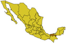
Tabasco
Macuspana is a city in Macuspana Municipality in the south-central part of the state of Tabasco in southeastern Mexico. The city of Macuspana had a 2005 census population of 30,661 and is the fifth-largest city in the state. It is the municipal seat of the municipality of Macuspana, which has an area of 2,551.7 km² (985.22 sq mi) and a population of 142,954, which includes numerous smaller communities. The largest of these communities is Benito Juárez (San Carlos).
Geography
The geographical vicinity is also known as the Macuspana Basin.
Climate
| Climate data for Macuspana | |||||||||||||
|---|---|---|---|---|---|---|---|---|---|---|---|---|---|
| Month | Jan | Feb | Mar | Apr | May | Jun | Jul | Aug | Sep | Oct | Nov | Dec | Year |
| Average high °C (°F) | 28.3 (82.9) |
29.8 (85.6) |
32.4 (90.3) |
34.6 (94.3) |
35.8 (96.4) |
34.7 (94.5) |
34.4 (93.9) |
34.3 (93.7) |
33.2 (91.8) |
31.7 (89.1) |
30.3 (86.5) |
28.7 (83.7) |
32.4 (90.3) |
| Average low °C (°F) | 18.1 (64.6) |
18.7 (65.7) |
20.1 (68.2) |
22 (71.6) |
23.1 (73.6) |
23.2 (73.8) |
22.9 (73.2) |
22.9 (73.2) |
22.9 (73.2) |
22 (72) |
20.6 (69.1) |
19 (66.2) |
21.3 (70.3) |
| Average precipitation mm (inches) | 150 (5.9) |
119 (4.7) |
69 (2.7) |
66 (2.6) |
124 (4.9) |
300 (11.8) |
201 (7.9) |
272 (10.7) |
399 (15.7) |
338 (13.3) |
206 (8.1) |
160 (6.3) |
2,400 (94.5) |
| Source: Weatherbase [1] | |||||||||||||
Name
The etymology of Macuspana's name is uncertain. The Enciclopedia de los municipios de México offers three possible explanations:
References
- Link to tables of population data from Census of 2005 INEGI: Instituto Nacional de Estadística, Geografía e Informática
- Macuspana Enciclopedia de los Municipios de México
- ↑ "Weatherbase: Historical Weather for Macuspana, Tabasco". Weatherbase. 2011. Retrieved on November 24, 2011.
Coordinates: 17°46′N 92°36′W / 17.767°N 92.600°W
This article is issued from
Wikipedia.
The text is licensed under Creative Commons - Attribution - Sharealike.
Additional terms may apply for the media files.