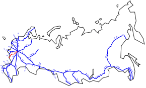
M2 highway (Russia)
Federal Highway M2 | ||||
|---|---|---|---|---|
| Федеральная автомобильная дорога M2 | ||||
| Crimea Highway | ||||
 | ||||
| Route information | ||||
|
Part of | ||||
| Length | 720 km (450 mi) | |||
| Existed | 1950 – present | |||
| Major junctions | ||||
| West end | Ukrainian border | |||
| East end | Moscow | |||
| Highway system | ||||
| ||||

The Russian route M2 (also known as the Crimea Highway, (автодорога "Крым")) is a major trunk road that connects Moscow to the Crimea. It is part of the European route E105. The length is 720 kilometres.
Inaugurated in 1950, the highway starts at the junction of the Moscow Ring Road and Varshavskoye Shosse and travels south-west, immediately bypassing the cities of Tula, Oryol, Kursk and Belgorod before terminating at the border with Ukraine. (Due to the accession of Crimea to the Russian Federation, is unknown at this point if the road will extend into Crimea.)
West of the border at Hoptivka, the road continues through Kharkov and Zaporizhia to Simferopol and Yalta as the Ukrainian M20 and M18. It is used by Russian summer vacationers who travel to the Black Sea resorts of Crimea.
History
At the heart of the route of the road lies the ancient Crimean tract. The highway Moscow - Kharkov section was built in 1840-60. The road was completely renovated in 1946-50, Getting asphalt cover. The route Moscow - Kharkiv - Simferopol in the Soviet period had the number 4.
By the time of the 1980 Summer Olympics in Moscow, it was decided to build a high-speed road understudy. Olympic Torch Relay took place partly on the new road, despite the fact that only a part of the route in the Moscow region and the junction with the Ring Road was completed in 1980. This was the first interchange in the Soviet Union, the traffic movement on which was carried out in three levels.
See also
- Berlinka, the never-completed Reichsautobahn Berlin-Königsberg of the Third Reich into East Prussia.
| M |  | |
|---|---|---|
| R |
| |
| A |
| |