Mórichida
| Mórichida Mursella (in Latin) | ||
|---|---|---|
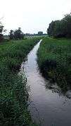
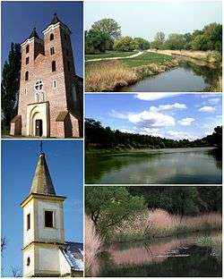 St. James Church, Lutheran church, Marcal river bank, Kaszalapi Lake, Marcal River | ||
| ||
 Mórichida Location of Mórichida | ||
| Coordinates: 47°30′45″N 17°25′17″E / 47.51246°N 17.42147°ECoordinates: 47°30′45″N 17°25′17″E / 47.51246°N 17.42147°E | ||
| Country |
| |
| County | Győr-Moson-Sopron | |
| Area | ||
| • Total | 32.31 km2 (12.47 sq mi) | |
| Population (2013) | ||
| • Total | 818 | |
| • Density | 25,91/km2 (6,710/sq mi) | |
| Time zone | UTC+1 (CET) | |
| • Summer (DST) | UTC+2 (CEST) | |
| Postal code | 9131 | |
| Area code(s) | 96 | |

Mórichida is a village in Győr-Moson-Sopron county, Hungary. The north-western part of Hungary, the Little Plain, the Marcal and Raba valley away. Right bank of the River Marcal.
Sights
- St. Jacob church (1251)
- Lutheran church (1789)
- Vineyards (1814)
- Nature: Rába, Marcal, Kaszalapi Lake
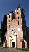 St. Jacob church
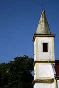 Lutheran church
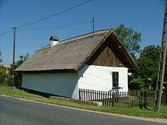 Old house
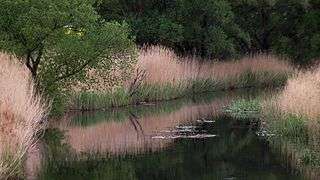
 Csángota
Born in Mórichida
- Fehér Dániel (Nagymórichida–Tekepuszta, 1890. – Sopron, 1955.) Forest engineer, microbiologist, plant physiologist, botanist.
External links
- Street map (in Hungarian)
This article is issued from
Wikipedia.
The text is licensed under Creative Commons - Attribution - Sharealike.
Additional terms may apply for the media files.