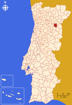
Mêda, Portugal
| Mêda | |||
|---|---|---|---|
| Municipality | |||
| |||
 | |||
| Coordinates: 40°58′N 7°16′W / 40.967°N 7.267°WCoordinates: 40°58′N 7°16′W / 40.967°N 7.267°W | |||
| Country |
| ||
| Region | Centro | ||
| Subregion | Beira Interior Norte | ||
| Intermunic. comm. | Beiras e Serra da Estrela | ||
| District | Guarda | ||
| Parishes | 11 | ||
| Government | |||
| • President | João Leal Pinto (PSD) | ||
| Area | |||
| • Total | 286.05 km2 (110.44 sq mi) | ||
| Population (2011) | |||
| • Total | 5,202 | ||
| • Density | 18/km2 (47/sq mi) | ||
| Time zone | WET/WEST (UTC+0/+1) | ||
| Website | http://www.cm-meda.pt | ||


Mêda (Portuguese pronunciation: [ˈmeðɐ]) is a municipality in Portugal. The population in 2011 was 5,202,[1] in an area of 286.05 km².[2] The city of Mêda proper had a population of 2,004 in 2001.[3] It was promoted to city in December 2004.
Municipality
The municipality is located in Guarda District, Centro Region, Beira Interior Norte Subregion. The present Mayor is Anselmo Sousa. The municipal holiday is November 11.
Main monument:
- Marialva Castle/Castelo de Marialva.
Also nearby in the municipalities of Foz Côa and Pinhel is the: Prehistoric Rock-Art Site of the Côa Valley, a World Heritage site.
Parishes
Administratively, the municipality is divided into 11 civil parishes (freguesias):[4]
- Aveloso
- Barreira
- Coriscada
- Longroiva
- Marialva
- Mêda, Outeiro de Gatos e Fonte Longa
- Poço do Canto
- Prova e Casteição
- Rabaçal
- Ranhados
- Vale Flor, Carvalhal e Pai Penela
See also
References
- ↑ Instituto Nacional de Estatística
- ↑ Direção-Geral do Território Archived 2014-09-29 at Archive.is
- ↑ UMA POPULAÇÃO QUE SE URBANIZA, Uma avaliação recente - Cidades, 2004 Nuno Pires Soares, Instituto Geográfico Português (Geographic Institute of Portugal)
- ↑ Diário da República. "Law nr. 11-A/2013, page 552 69" (pdf) (in Portuguese). Retrieved 28 July 2014.
External links
This article is issued from
Wikipedia.
The text is licensed under Creative Commons - Attribution - Sharealike.
Additional terms may apply for the media files.