Ludza River
Coordinates: 57°12′51″N 28°8′19″E / 57.21417°N 28.13861°E
| Ludza | |
|---|---|
 | |
| Country | Latvia, Russia |
| Physical characteristics | |
| Main source | Lake Lielais Ludzas |
| River mouth | Utroya |
| Length | 156 kilometres (97 mi)[1] |
| Discharge |
|
| Basin features | |
| Basin size | 1,540 km2 (590 sq mi)[1] |
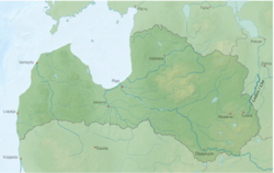
The Ludza (Latvian: Ludza, Russian: Лжа, Lzha) is a 156 kilometres (97 mi) long river in Ludza, Cibla, and Kārsava municipalities of Latvia and in Krasnogorodsky and Pytalovsky Districts of Pskov Oblast of Russia. It is a right tributary of the Utroya.
The source of the Ludza is Lake Lielais Ludzas near the town of Ludza, Latvia. The river flows east, turns north and a part of it forms the international border between Latvia and Russia. Further north, it turns northeast and departs to the Russian side, forming the border between Krasnogorosdky and Pytalovsky Districts of Pskov Oblast. In Russia, the Ludza is known as the Lzha. Even further north, the Lzha turns north and joins the Utroya close to the village of Khudyaki.
References
- 1 2 150020 Река Лжа (Лудза, Льжа) Check
|url=value (help) (in Russian). State Water Register of Russia. Retrieved 17 July 2012.