Lužnice (river)
| Lužnice | |
| River | |
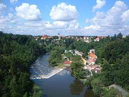 The Lužnice near Bechyně | |
| Countries | Czech Republic, Austria |
|---|---|
| Tributaries | |
| - right | Nežárka |
| Cities | Soběslav, Tábor |
| Source | |
| - location | Gratzen Mountains, Austria |
| - elevation | 970 m (3,182 ft) |
| - coordinates | 48°35′50.6″N 14°43′54″E / 48.597389°N 14.73167°E |
| Mouth | Vltava |
| - coordinates | 49°13′49.7″N 14°23′21″E / 49.230472°N 14.38917°ECoordinates: 49°13′49.7″N 14°23′21″E / 49.230472°N 14.38917°E |
| Length | 197.4[1] km (123 mi) |
| Basin | 4,226.2 km2 (1,632 sq mi) |
| Discharge | mouth |
| - average | 24.3 m3/s (858 cu ft/s) |
| Progression | Vltava→ Elbe→ North Sea |
_-_location_and_watershed_map.svg.png) The Lužnice and its watershed until it enters the Vltava (magenta) | |
The Lužnice (Czech pronunciation: [ˈluʒɲɪtsɛ] (![]()
The river was first mentioned in sources in the year 1179. The name was derived from an old Czech word for water flowing through meadows.
Several places on the river are popular destinations for recreation and canoeing.
Towns and cities on the Lužnice river
References
- ↑ Niederösterreich Atlas (Lower Austria)
External links
| Wikimedia Commons has media related to Lužnice. |
- Basic information (in English)
- Detailed information (in Czech)
This article is issued from
Wikipedia.
The text is licensed under Creative Commons - Attribution - Sharealike.
Additional terms may apply for the media files.