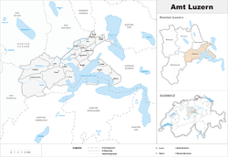
Lucerne District
- For the district in Gatineau, Quebec, see Lucerne District (Gatineau)
| Lucerne District Amt Luzern | |
|---|---|
| District | |
 | |
| Country |
|
| Canton |
|
| Capital | Lucerne |
| Area | |
| • Total | 259.92 km2 (100.36 sq mi) |
| Population (2017) | |
| • Total | 176,710 |
| • Density | 680/km2 (1,800/sq mi) |
| Time zone | UTC+1 (CET) |
| • Summer (DST) | UTC+2 (CEST) |
| Municipalities | 18 |
Lucerne District (German: Luzern) is a former Amt (administrative district) of the Canton of Lucerne, Switzerland. It had a population of 176,710 (as of 2013) and consisted of 18 municipalities, of which the city of Lucerne is the largest and the district capital. On 1 January 2013 the Amt was divided into two Wahlkreis, Lucerne-Stadt and Lucerne-Land.[1]
| Municipalities | Population (31 December 2017)[2] |
Area (km²) |
|---|---|---|
| Adligenswil | 5,343 | 6.99 |
| Buchrain | 6,116 | 4.80 |
| Dierikon | 1,503 | 2.78 |
| Ebikon | 13,531 | 9.69 |
| Gisikon | 1,331 | 1.08 |
| Greppen | 1,075 | 5.25 |
| Honau | 391 | 1.25 |
| Horw | 13,915 | 20.43 |
| Kriens | 26,997 | 27.31 |
| Lucerne | 81,401 | 29.04b |
| Malters | 7,231 | 28.57 |
| Meggen | 7,138 | 13.93 |
| Meierskappel | 1,369 | 9.23 |
| Root | 4,995 | 8.65 |
| Schwarzenberg | 1,690 | 39.31 |
| Udligenswil | 2,279 | 6.22 |
| Vitznau | 1,381 | 11.76 |
| Weggis | 4,404 | 25.29 |
| District of Lucerne | 176,710 | 259.92[3]a |
Mergers
On 1 January 2010 the municipality of Littau merged into the municipality of Lucerne.[4]
References
- ↑ Nomenklaturen – Amtliches Gemeindeverzeichnis der Schweiz (in German) accessed 9 February 2013
- ↑ Swiss Federal Statistical Office - STAT-TAB, online database – Ständige und nichtständige Wohnbevölkerung nach institutionellen Gliederungen, Geburtsort und Staatsangehörigkeit (in German) accessed 17 September 2018
- ↑ LUSTAT-Canton of Lucerne Statistical Office Archived 2012-02-29 at the Wayback Machine. as of 2000 survey, (in German) accessed 25 August 2009
- ↑ Amtliches Gemeindeverzeichnis der Schweiz, Mutationsmeldungen 2009 / Répertoire officiel des communes de Suisse, Mutations 2009 / Elenco ufficiale dei Comuni della Svizzera, Mutazione 2009 (PDF) (Report). Federal Statistical Office. 2009. 3161. Archived from the original (PDF) on 18 November 2010. Retrieved 6 March 2010.
This article is issued from
Wikipedia.
The text is licensed under Creative Commons - Attribution - Sharealike.
Additional terms may apply for the media files.