Luís Correia
| Luís Correia | |
|---|---|
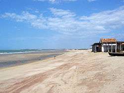 Arrombada beach in Luís Correia | |
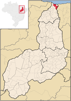 Location in Piauí and Brazil | |
| Coordinates: 02°52′44″S 41°40′01″W / 2.87889°S 41.66694°WCoordinates: 02°52′44″S 41°40′01″W / 2.87889°S 41.66694°W | |
| Country | Brazil |
| Region | Northeast |
| State | Piauí |
| Settled | July 26, 1938 |
| Government | |
| • Mayor | Heriberto Ribeiro de Oliveira (PPS) |
| Area | |
| • Total | 1,071.276 km2 (413.622 sq mi) |
| Elevation | 10 m (30 ft) |
| Population (2008)[1] | |
| • Total | 26,900 |
| • Density | 24.0/km2 (62/sq mi) |
| Time zone | UTC-3 (UTC-3) |
Luís Correia is one of the four coastal cities of Piauí, Brazil.
The municipality contains part of the 313,800 hectares (775,000 acres) Delta do Parnaíba Environmental Protection Area, created in 1996.[2] The municipality also contains part of the 1,592,550 hectares (3,935,300 acres) Serra da Ibiapaba Environmental Protection Area, created in 1996.[3]
References
- ↑ 2008 population statistics of IBGE
- ↑ APA Delta do Parnaíba (Federal) (in Portuguese), ISA: Instituto Socioambiental, retrieved 2017-02-09
- ↑ APA Serra da Ibiapaba (in Portuguese), ISA: Instituto Socioambiental, retrieved 2017-02-10
This article is issued from
Wikipedia.
The text is licensed under Creative Commons - Attribution - Sharealike.
Additional terms may apply for the media files.