List of provincial parks of Southwestern Ontario
This is a list of provincial parks in Southwestern Ontario. These provincial parks are maintained by Ontario Parks. For a list of other provincial parks in Ontario, see the List of provincial parks in Ontario.
Bruce County
Chatham-Kent
| # | WD-Item | Name | Established | Commons category | Picture | Coordinates | Upload |
|---|---|---|---|---|---|---|---|
| 1 | Q29106984 | Clear Creek Forest Provincial Park | 2014 | 42°28′20″N 81°43′24″W / 42.472314°N 81.723261°W | |||
| 2 | Q3364682 | Rondeau Provincial Park | 1894 | Rondeau Provincial Park | .JPG) |
42°17′00″N 81°52′00″W / 42.2833°N 81.8667°W | |
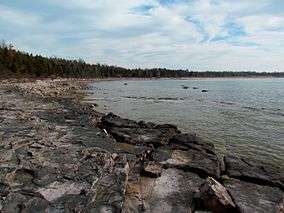
| 3 | Q7991937 | Wheatley Provincial Park | 1971 | Wheatley Provincial Park | 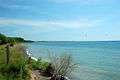 |
42°05′24″N 82°26′50″W / 42.09°N 82.4472°W |
Elgin County
| # | WD-Item | Name | Established | Commons category | Picture | Coordinates | Upload |
|---|---|---|---|---|---|---|---|
| 1 | Q22481156 | John E. Pearce Provincial Park | 1957 | 42°36′29″N 81°26′48″W / 42.608055555556°N 81.446666666667°W | |||
| 2 | Q22553804 | Port Bruce Provincial Park | 1974 | 42°39′18″N 81°00′48″W / 42.655°N 81.013333333333°W | |||
| 3 | Q22553813 | Port Burwell Provincial Park (formerly Iroquois Beach Provincial Park 1971-1986) | 1971 | 42°38′53″N 80°48′58″W / 42.648055555556°N 80.816111111111°W |
Essex County
| # | WD-Item | Name | Established | Commons category | Picture | Coordinates | Upload |
|---|---|---|---|---|---|---|---|
| 1 | Q15641699 | East Sister Island Provincial Nature Reserve | 41°48′47″N 82°51′21″W / 41.81317°N 82.85576°W | ||||
| 2 | Q29107009 | Fish Point Provincial Nature Reserve | 1985 | 41°44′15″N 82°40′17″W / 41.7376°N 82.67139°W | |||
| 3 | Q29107062 | Lighthouse Point Provincial Nature Reserve | 1985 | 41°49′32″N 82°38′21″W / 41.8255°N 82.63928°W | |||
| 4 | Q29107119 | Ojibway Prairie Provincial Nature Reserve | 1977 | 42°15′56″N 83°04′36″W / 42.2655556°N 83.0766666°W |
Grey County
| # | WD-Item | Name | Established | Commons category | Picture | Coordinates | Upload |
|---|---|---|---|---|---|---|---|
| 1 | Q28966826 | Bayview Escarpment Provincial Nature Reserve | 1985 | 44°38′12″N 80°42′39″W / 44.636666666667°N 80.710833333333°W | |||
| 2 | Q5181712 | Craigleith Provincial Park | 1967 | 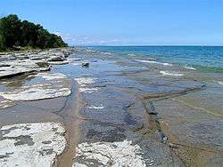 |
44°32′12″N 80°20′55″W / 44.5367°N 80.3486°W | ||
| 3 | Q28714179 | Duncan Escarpment Provincial Nature Reserve | 1985 | 44°25′01″N 80°27′58″W / 44.416944444444°N 80.466111111111°W | |||
| 4 | Q22565722 | Pretty River Valley Provincial Park | 1985 | 44°25′36″N 80°17′25″W / 44.426666666667°N 80.290277777778°W |
Haldimand County
| # | WD-Item | Name | Established | Commons category | Picture | Coordinates | Upload |
|---|---|---|---|---|---|---|---|
| 1 | Q22469956 | James N. Allan Provincial Park | 1989 | 42°50′58″N 79°39′48″W / 42.84948°N 79.663466°W | |||
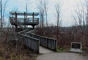
| 2 | Q7354632 | Rock Point Provincial Park | 1957 | Rock Point Provincial Park | 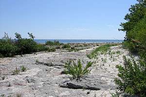 |
42°50′54″N 79°33′09″W / 42.8482°N 79.5525°W | |
| 3 | Q22560575 | Selkirk Provincial Park | 1967 | 42°48′50″N 79°57′32″W / 42.813888888889°N 79.958888888889°W |
Huron County
| # | WD-Item | Name | Established | Commons category | Picture | Coordinates | Upload |
|---|---|---|---|---|---|---|---|
| 1 | Q28606644 | Morris Tract Provincial Nature Reserve | 1997 | 43°43′37″N 81°38′36″W / 43.726944444444°N 81.643333333333°W | |||
| 2 | Q22414229 | Point Farms Provincial Park | 1970 | 43°48′18″N 81°43′02″W / 43.805°N 81.717222222222°W |
Lambton County
| # | WD-Item | Name | Established | Commons category | Picture | Coordinates | Upload |
|---|---|---|---|---|---|---|---|
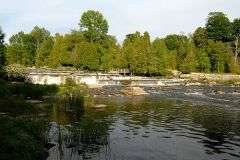
| 1 | Q7195555 | The Pinery Provincial Park | 1957 | Pinery Provincial Park | 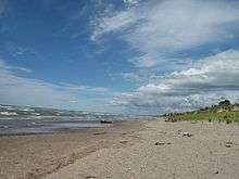 |
43°15′36″N 81°49′40″W / 43.26°N 81.8278°W |
Middlesex County
| # | WD-Item | Name | Established | Commons category | Picture | Coordinates | Upload |
|---|---|---|---|---|---|---|---|
| 1 | Q22550947 | Komoka Provincial Park | 1989 | 42°57′00″N 81°23′51″W / 42.95°N 81.3975°W |
Norfolk County
| # | WD-Item | Name | Established | Commons category | Picture | Coordinates | Upload |
|---|---|---|---|---|---|---|---|
| 1 | Q3364675 | Long Point Provincial Park | 1921 | Long Point Provincial Park | 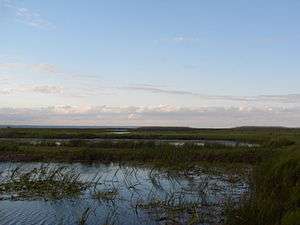 |
42°34′48″N 80°23′06″W / 42.58°N 80.385°W | |
| 2 | Q3364694 | Turkey Point Provincial Park | 1959 |  |
42°42′17″N 80°20′00″W / 42.7047°N 80.3333°W |
Oxford County
| # | WD-Item | Name | Established | Commons category | Picture | Coordinates | Upload |
|---|---|---|---|---|---|---|---|
| 1 | Q29107165 | Trillium Woods Provincial Park | 1969 | 43°03′50″N 80°46′40″W / 43.06377°N 80.77787°W |
This article is issued from
Wikipedia.
The text is licensed under Creative Commons - Attribution - Sharealike.
Additional terms may apply for the media files.