List of listed buildings in Harris
This is a list of listed buildings in the parish of Harris in the Western Isles of Scotland.
List
| Name | Location | Date Listed | Grid Ref. [note 1] | Geo-coordinates | Notes | HB Number [note 2] | Image |
|---|---|---|---|---|---|---|---|
| Scalpay, Eilean Glas Lighthouse, Old Lighthouse, Store And Enclosure Wall, Keeper's Cottages, Outbuildings, Jetty And Foghorn | 57°51′26″N 6°38′20″W / 57.857108°N 6.638994°W | Category A | 13487 |  | |||
| Rodel, Building At Ngr Ng 0461/8330 | 57°44′31″N 6°57′56″W / 57.741976°N 6.965682°W | Category B | 12908 | | |||
| Amhuinnsuidhe, Screen Walls, Gates And Gatepiers, To East Of Mansion | 57°57′48″N 6°59′42″W / 57.963372°N 6.99511°W | Category B | 12746 | | |||
| Amhuinnsuidhe, Boathouse | 57°57′53″N 6°59′51″W / 57.964769°N 6.997557°W | Category B | 12749 | | |||
| Tarbert, West Loch, House At Pier | 57°54′00″N 6°48′52″W / 57.900072°N 6.814475°W | Category C(S) | 12602 | | |||
| Berneray Thatched Cottage At Laimrig Ruadh At Os Grid Reference Nf 92957 81549 | 57°43′06″N 7°09′31″W / 57.718384°N 7.158612°W | Category B | 46100 | | |||
| Berneray Thatched Cottage At Baile (Gatliffe Trust) | 57°43′02″N 7°09′14″W / 57.71733°N 7.154006°W | Category B | 46103 | | |||
| Berneray Risgary Barn And Byre | 57°43′06″N 7°09′14″W / 57.71831°N 7.154011°W | Category B | 46108 | | |||
| Berneray Parish Church | 57°43′12″N 7°10′29″W / 57.71995°N 7.174642°W | Category C(S) | 49877 | | |||
| Rodel, Building At Ngr Ng 0493/8286 | 57°44′18″N 6°57′36″W / 57.738306°N 6.959946°W | Category C(S) | 12909 | | |||
| Ardseilhb/Manish School And Schoolhouse | 57°48′06″N 6°52′01″W / 57.801618°N 6.867006°W | Category B | 12750 | | |||
| Aline, Roadbridge (A859 Over Amhainn A'Mhuil) | 58°00′28″N 6°45′10″W / 58.007905°N 6.752853°W | Category C(S) | 12766 | | |||
| Berneray Davaar Cottage (At Pol An Oir) | 57°42′39″N 7°10′38″W / 57.710813°N 7.177168°W | Category C(S) | 46097 | | |||
| Berneray Thatched Cottages At Os Grid Reference Nf 9272 8186 And Nf 9272 8187 | 57°43′16″N 7°09′47″W / 57.721023°N 7.16294°W | Category B | 46098 | | |||
| Berneray Thatched Cottage At Laimrig Ruadh At Os Grid Reference Nf 9296 8157 | 57°43′07″N 7°09′31″W / 57.718674°N 7.158553°W | Category B | 46101 | | |||
| Berneray Thatched Cottage At Laimrig Ruadh At Os Grid Reference Nf 9294 8159 | 57°43′08″N 7°09′32″W / 57.718785°N 7.158905°W | Category B | 46102 | | |||
| Ardvourlie Castle Including Garden Terrace Walls, Slipway And Bridge | 57°59′41″N 6°45′29″W / 57.994843°N 6.758148°W | Category B | 49675 | | |||
| Tarbert, The Pier, Tarbert Stores | 57°53′51″N 6°47′55″W / 57.897624°N 6.79862°W | Category C(S) | 50799 | | |||
| The Golden Road, Meavaig South, Muilinn Mhiabhaig (Meavag Mill) | 57°52′01″N 6°48′17″W / 57.866863°N 6.804661°W | Category C(S) | 50801 | | |||
| Leverburgh Water Tower | 57°46′04″N 7°01′10″W / 57.767816°N 7.019408°W | Category B | 12906 | | |||
| Rodel Harbour, Quays, Piers And Crane | 57°44′16″N 6°57′40″W / 57.737643°N 6.961016°W | Category B | 12910 | | |||
| Rodel St Clement's Church And Churchyard | 57°44′27″N 6°57′47″W / 57.740938°N 6.963033°W | Category A | 12912 | | |||
| Amhuinnsuidhe, Former Kennels | 57°57′47″N 6°59′42″W / 57.962971°N 6.995004°W | Category C(S) | 12748 | | |||
| Berneray Former Parliamentary Church | 57°43′22″N 7°09′26″W / 57.722755°N 7.157117°W | Category B | 46106 | | |||
| 1 Fleoideabhagh (Flodabay) | 57°47′50″N 6°53′01″W / 57.79709°N 6.883648°W | Category C(S) | 50802 | | |||
| Tarbert, Free Presbyterian Church | 57°53′54″N 6°47′50″W / 57.898256°N 6.797133°W | Category B | 12866 | | |||
| Tarbert Primary School And Schoolhouse | 57°54′04″N 6°48′46″W / 57.901144°N 6.812777°W | Category B | 12867 | | |||
| Amhuinnsuidhe, Mansion House, Including Sea-Walls And Retaining Walls | 57°57′41″N 6°59′26″W / 57.961379°N 6.990431°W | Category A | 12767 | | |||
| Berneray Thatched Cottage At Baile At Os Grid Reference Nf 9315 8140 | 57°43′02″N 7°09′18″W / 57.717224°N 7.15505°W | Category B | 46104 | | |||
| Berneray Former Parliamentary Manse | 57°43′27″N 7°09′25″W / 57.724153°N 7.157013°W | Category B | 46107 | | |||
| Scaristamore Scarista House Including Outbuilding | 57°49′30″N 7°02′31″W / 57.825054°N 7.041851°W | Category B | 12863 | 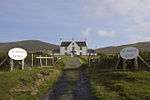 | |||
| Tarbert, Church Of Scotland Manse | 57°53′50″N 6°47′50″W / 57.897116°N 6.797285°W | Category C(S) | 12865 | | |||
| Amhuinnsuidhe, Archway And Adjoining Buildings, Including, Cottages | 57°57′42″N 6°59′31″W / 57.961721°N 6.992019°W | Category B | 12747 | | |||
| Horsacleit | 57°51′53″N 6°49′23″W / 57.864708°N 6.823008°W | Category B | 12752 | | |||
| Manish Former Free Church Manse | 57°47′53″N 6°52′47″W / 57.797919°N 6.879666°W | Category C(S) | 12755 | | |||
| Berneray Thatched Cottage At Baile At Os Grid Reference Nf 9314 8138 | 57°43′01″N 7°09′19″W / 57.717072°N 7.155264°W | Category B | 46105 | | |||
| Rodel Hotel | 57°44′18″N 6°57′46″W / 57.738447°N 6.962758°W | Category B | 12911 | | |||
| Tarbert, Church Of Scotland | 57°53′49″N 6°47′46″W / 57.897036°N 6.796092°W | Category C(S) | 12864 | | |||
| The Golden Road, No 9A Quidinish | 57°46′49″N 6°54′02″W / 57.780331°N 6.900595°W | Category B | 50800 | | |||
| Leverburgh Water Reservoir | 57°46′05″N 7°01′10″W / 57.76797°N 7.019396°W | Category B | 12907 | | |||
| Manish Free Church | 57°47′53″N 6°52′48″W / 57.798029°N 6.880068°W | Category B | 12754 | | |||
| Tarbert, West Loch, Pier | 57°54′02″N 6°49′02″W / 57.900622°N 6.817286°W | Category C(S) | 12604 | | |||
| Berneray Thatched Cottage At Os Grid Reference Nf 9276 8182 | 57°43′15″N 7°09′44″W / 57.720771°N 7.162282°W | Category C(S) | 46099 | | |||
| Scaristamore, Harris Parish Church | 57°49′27″N 7°02′32″W / 57.824119°N 7.042276°W | Category B | 13488 | |
Key
The scheme for classifying buildings in Scotland is:
- Category A: "buildings of national or international importance, either architectural or historic; or fine, little-altered examples of some particular period, style or building type."[1]
- Category B: "buildings of regional or more than local importance; or major examples of some particular period, style or building type, which may have been altered."[1]
- Category C: "buildings of local importance; lesser examples of any period, style, or building type, as originally constructed or moderately altered; and simple traditional buildings which group well with other listed buildings."[1]
In March 2016 there were 47,288 listed buildings in Scotland. Of these, 8 per cent were Category A, and 50 per cent were Category B, with the rest listed at Category C.[2]
See also
Notes
- ↑ Sometimes known as OSGB36, the grid reference (where provided) is based on the British national grid reference system used by the Ordnance Survey.
• "Guide to National Grid". Ordnance Survey. Retrieved 2007-12-12.
• "Get-a-map". Ordnance Survey. Retrieved 2007-12-17. - ↑ The "HB Number" is a unique number assigned to each listed building by Historic Environment Scotland.
References
- All entries, addresses and coordinates are based on data from Historic Scotland. This data falls under the Open Government Licence
- 1 2 3 "What is Listing?". Historic Environment Scotland. Retrieved 29 May 2018.
- ↑ Scotland's Historic Environment Audit 2016 (PDF). Historic Environment Scotland and the Built Environment Forum Scotland. pp. 15–16. Retrieved 29 May 2018.
This article is issued from
Wikipedia.
The text is licensed under Creative Commons - Attribution - Sharealike.
Additional terms may apply for the media files.