List of historic places in Sunbury County, New Brunswick
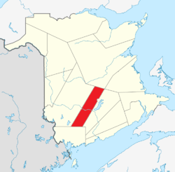
This article is a list of historic places in Sunbury County, New Brunswick entered on the Canadian Register of Historic Places, whether they are federal, provincial, or municipal.
List of historic places
| Name | Address | Coordinates | IDF | IDP | IDM | Image | |
|---|---|---|---|---|---|---|---|
| Belmont House / R. Wilmot Home National Historic Site of Canada | Lincoln Road (NB Route 102), Lincoln, NB | 45°54′49″N 66°35′14″W / 45.9136°N 66.5871°W | 1192 |  | |||
| George Brown House | 325 MacDonald Avenue, Oromocto, NB | 45°50′56″N 66°29′00″W / 45.8488°N 66.483370°W | 18391 | | |||
| Building 2 | Acadia Forest Experimental Station, Maugerville, NB | 46°09′59″N 66°17′00″W / 46.1665°N 66.2834°W | 4368 | | |||
| Building 8 | Acadia Forest Experimental Station, Maugerville, NB | 46°10′01″N 66°17′00″W / 46.1669°N 66.2834°W | 4371 | | |||
| Building 10 | Acadia Forest Experimental Station, Maugerville, NB | 46°10′00″N 66°17′00″W / 46.1667°N 66.2832°W | 4373 | | |||
| Building 11 | Acadia Forest Experimental Station, Maugerville, NB | 46°10′00″N 66°17′00″W / 46.1667°N 66.2834°W | 4372 | | |||
| Building 12 | Acadia Forest Experimental Station, Maugerville, NB | 46°10′00″N 66°17′01″W / 46.1667°N 66.2836°W | 4369 | | |||
| Building 15 | Acadia Forest Experimental Station, Maugerville, NB | 45°55′N 66°20′W / 45.91°N 66.33°W | 3152 | | |||
| Burpee-Bridges House | 2111 Rt. 105., Sheffield, NB | 45°53′07″N 66°21′35″W / 45.8853°N 66.3598°W | 5837 | | |||
| Christ Church Anglican National Historic Site of Canada | , Maugerville, NB | 45°52′17″N 66°26′47″W / 45.8713°N 66.4463°W | 12026 | | |||
| History of Coal Mining Monument | 187 Main Street (adjacent), Minto, NB | 46°04′32″N 66°04′24″W / 46.0755°N 66.0734°W | 12242 | | |||
| Oromocto Cenotaph | MacDonald Avenue, Oromocto, NB | 45°51′03″N 66°28′27″W / 45.8509°N 66.4743°W | 18392 | | |||
| St. John's Anglican Church and Graveyard | 60 Broad Road, Oromocto, NB | 45°50′59″N 66°28′21″W / 45.8497°N 66.4725°W | 18389 | | |||
| Wolastoq National Historic Site of Canada | Entire watershed of Saint John River, central and western New Brunswick, parts of southeastern Quebec, NB | 45°51′47″N 66°27′22″W / 45.8630°N 66.4562°W | 18954 | 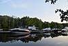 More images | |||
| Yeamans House | 4 Yeamans Road, Minto, NB | 46°04′37″N 66°03′00″W / 46.077°N 66.0499°W | 12243 | 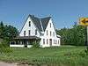 |
See also
| Wikimedia Commons has media related to Cultural heritage monuments in New Brunswick. |
This article is issued from
Wikipedia.
The text is licensed under Creative Commons - Attribution - Sharealike.
Additional terms may apply for the media files.