Levski Peak (Antarctica)
| Levski Peak | |
|---|---|
 Levski Peak from Pirdop Gate | |
| Highest point | |
| Elevation | 1,430 m (4,690 ft) |
| Coordinates | 62°39′47.7″S 60°07′03″W / 62.663250°S 60.11750°WCoordinates: 62°39′47.7″S 60°07′03″W / 62.663250°S 60.11750°W |
| Geography | |
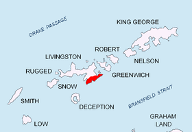
| Location | Livingston Island, Antarctica |
| Parent range | Tangra Mountains |
| Climbing | |
| First ascent | unclimbed |

Levski Peak (Bulgarian: Връх Левски, Vrah Levski \'vr&h 'lev-ski\) is a mountain in Antarctica, rising to approximately 1,430 m (4,692 ft) in the western extremity of Levski Ridge, Tangra Mountains on Livingston Island in the South Shetland Islands, Antarctica. It surmounts Huron Glacier to the north and Macy Glacier to the south. The peak was named after Vasil Levski (1837–1873), a national hero of the Bulgarian liberation movement.
Location
The peak is located to the east of Shipka Saddle, 1.3 km (0.81 mi) east of Lyaskovets Peak, 3.78 km (2.35 mi) southeast of Kuzman Knoll, 5.37 km (3.34 mi) south of Atanasoff Nunatak, 3.32 km (2.06 mi) west by north of Great Needle Peak (Falsa Aguja), and 3.46 km (2.15 mi) km north by west of St. Naum Peak.
Maps
- South Shetland Islands. Scale 1:200000 topographic map. DOS 610 Sheet W 62 60. Tolworth, UK, 1968.
- Islas Livingston y Decepción. Mapa topográfico a escala 1:100000. Madrid: Servicio Geográfico del Ejército, 1991.
- S. Soccol, D. Gildea and J. Bath. Livingston Island, Antarctica. Scale 1:100000 satellite map. The Omega Foundation, USA, 2004.
- L.L. Ivanov et al., Antarctica: Livingston Island and Greenwich Island, South Shetland Islands (from English Strait to Morton Strait, with illustrations and ice-cover distribution), 1:100000 scale topographic map, Antarctic Place-names Commission of Bulgaria, Sofia, 2005
- L.L. Ivanov. Antarctica: Livingston Island and Greenwich, Robert, Snow and Smith Islands. Scale 1:120000 topographic map. Troyan: Manfred Wörner Foundation, 2010. ISBN 978-954-92032-9-5 (First edition 2009. ISBN 978-954-92032-6-4)
- Antarctic Digital Database (ADD). Scale 1:250000 topographic map of Antarctica. Scientific Committee on Antarctic Research (SCAR), 1993–2016.
References
- Levski Peak. SCAR Composite Antarctic Gazetteer
- Bulgarian Antarctic Gazetteer. Antarctic Place-names Commission. (details in Bulgarian, basic data in English)
This article includes information from the Antarctic Place-names Commission of Bulgaria which is used with permission.