Leuscheid
| Leuscheid | |
|---|---|
| Highest point | |
| Peak | Hoher Schaden, Beulskopf |
| Elevation | 388 m (1,273 ft) |
| Geography | |
| State | Rhein-Sieg-Kreis, North Rhine-Westphalia, and Altenkirchen, Rhineland-Palatinate |
| Range coordinates | 50°44′19″N 7°33′44″E / 50.738670°N 7.562329°ECoordinates: 50°44′19″N 7°33′44″E / 50.738670°N 7.562329°E |
| Parent range | Mittelsieg Upland and Westerwald |
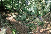
The basalt quarry of Blauer Stein near Kuchhausen
The Leuscheid is a mainly wooded hill ridge on the border between the German states of North Rhine-Westphalia and Rhineland-Palatinate in the extreme north of the Westerwald range. From a natural region perspective, however, it is not seen as part of the Westerwald natural region but belongs to the Mittelsieg Upland (major unit 330) and thus to the Süderbergland (major unit group 33).
References
External links
- BfN-Landschaftssteckbrief Südliches Mittelsieg-Bergland (Leuscheid and Nister Upland)
- Landschaftssteckbrief Leuscheid - Landschaftsinformationssystem der Naturschutzverwaltung Rheinland-Pfalz
- Photos of the Wohmbach valley
This article is issued from
Wikipedia.
The text is licensed under Creative Commons - Attribution - Sharealike.
Additional terms may apply for the media files.