Les Bans
| Les Bans | |
|---|---|
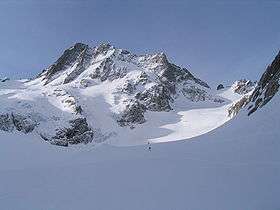 North face of Les Bans at the head of the Vénéon valley | |
| Highest point | |
| Elevation | 3,669 m (12,037 ft) |
| Coordinates | 44°50′54″N 6°20′10″E / 44.84833°N 6.33611°ECoordinates: 44°50′54″N 6°20′10″E / 44.84833°N 6.33611°E |
| Geography | |
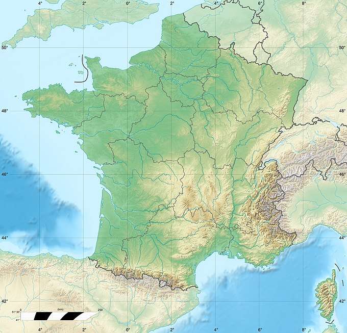 Les Bans France | |
| Location | Hautes-Alpes/Isère, France |
| Parent range | Dauphiné Alps |
| Climbing | |
| First ascent | July 14, 1878 by W. A. B. Coolidge, Christian Almer and U. Almer |
| Easiest route | PD+ (glacier approach, rock scramble) |
Les Bans (3,669 m) is a mountain in the Massif des Écrins in the Dauphiné Alps, first climbed by W. A. B. Coolidge, Christian Almer and U. Almer on July 14, 1878.
There are three main summits on the mountain:
- South summit 3,669 m
- North-west summit 3,630 m
- North summit 3,662 m
Huts
- Chalet Hôtel du Gioberney (1,700 m)
- Les Bans hut (2,076 m)
- Pilatte refuge (2,580 m)
Gallery
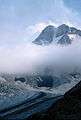 North face, from the Pilatte hut
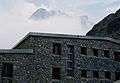 Pilatte hut, with the mountain in the background
External links
This article is issued from
Wikipedia.
The text is licensed under Creative Commons - Attribution - Sharealike.
Additional terms may apply for the media files.