Le Hommet-d'Arthenay
| Le Hommet-d'Arthenay | |
|---|---|
 | |
 Le Hommet-d'Arthenay Location within Normandy region  Le Hommet-d'Arthenay | |
| Coordinates: 49°11′26″N 1°11′12″W / 49.1906°N 1.1867°WCoordinates: 49°11′26″N 1°11′12″W / 49.1906°N 1.1867°W | |
| Country | France |
| Region | Normandy |
| Department | Manche |
| Arrondissement | Saint-Lô |
| Canton | Pont-Hébert |
| Area1 | 14.85 km2 (5.73 sq mi) |
| Population (2006)2 | 432 |
| • Density | 29/km2 (75/sq mi) |
| Time zone | UTC+1 (CET) |
| • Summer (DST) | UTC+2 (CEST) |
| INSEE/Postal code | 50248 /50620 |
| Elevation |
0–54 m (0–177 ft) (avg. 4 m or 13 ft) |
| Website | www.mairie-lehommetdarthenay.com |
|
1 French Land Register data, which excludes lakes, ponds, glaciers > 1 km2 (0.386 sq mi or 247 acres) and river estuaries. 2 Population without double counting: residents of multiple communes (e.g., students and military personnel) only counted once. | |
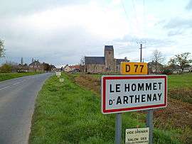
Le Hommet-d'Arthenay is a former commune in the Manche department in north-western France. On 1 January 2018, it was merged into the commune of Pont-Hébert.[1]
See also
References
- ↑ Arrêté préfectoral 13 December 2017 (in French)
| Wikimedia Commons has media related to Le Hommet-d'Arthenay. |
This article is issued from
Wikipedia.
The text is licensed under Creative Commons - Attribution - Sharealike.
Additional terms may apply for the media files.