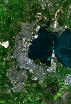
Lara, Victoria
| Lara Geelong, Victoria | |||||||||||||||
|---|---|---|---|---|---|---|---|---|---|---|---|---|---|---|---|
 Lara | |||||||||||||||
| Coordinates | 38°01′0″S 144°25′0″E / 38.01667°S 144.41667°ECoordinates: 38°01′0″S 144°25′0″E / 38.01667°S 144.41667°E | ||||||||||||||
| Population | 16,355 (2016 census)[1] | ||||||||||||||
| • Density | 1,128/km2 (2,921/sq mi) | ||||||||||||||
| Postcode(s) | 3212 | ||||||||||||||
| Area | 14.5 km2 (5.6 sq mi) | ||||||||||||||
| LGA(s) | City of Greater Geelong | ||||||||||||||
| State electorate(s) | Lara | ||||||||||||||
| Federal Division(s) | Corio | ||||||||||||||
| |||||||||||||||
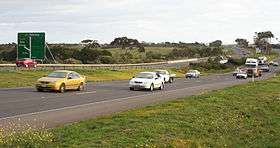
Lara is a small town north of the City of Greater Geelong, 18 km north-east of the Geelong CBD, inland from the Princes Freeway to Melbourne.
History
The explorers Hume and Hovell arrived at Lara on December 16, 1824, believing that they had reached Westernport Bay. They recorded that the Aboriginals described the bay as Djillong and land as Corayo, suggesting origins for the names of Geelong and Corio.
The area was originally named Kennedy's Creek but was also given several different names including Duck Ponds, Hovell's Creek, Cheddar, Swindon and Lara Lake. The area of Lara was no more than a few farms at this time.
The railway though the town was opened in 1857 along with the local railway station,[2] with several subdivisions then announced. A Post Office opened on 1 March 1858 as Duck Ponds, renamed Hovell's Creek in 1872, and finally Lara in 1884.[3] The population grew to a few hundred by 1890, and several facilities like schools and churches were built, but a municipal water supply was not completed until 1947.
In January 1969, 17 people were killed in bushfires which ravaged Lara. Most of the victims were trapped by the fast-moving grass fire while travelling on the Princes Highway.
Several scenes from the 1979 feature film Mad Max were shot on location around Lara, as well as several scenes from the Australian Broadcasting Corporation mockumentary We Can Be Heroes: Finding The Australian of the Year, in which the town carried the fictional name "Dunt".
The town's history is being preserved at the Lara Museum and Historical Centre on the corner of Forest and Canterbury Roads. This historic property, formerly the Lake Bank Hotel (circa 1860), was renovated by local businessman Lino Bisinella and provided in 2013 to the community group which runs the museum, Lara Heritage and Historical Inc.
Heritage listed sites
Lara contains a number of heritage listed sites, including:
- 605 Bacchus Marsh Road, Elcho Homestead [4]
- Princes Highway, Hume and Hovell Monument [5]
- 108 Windermere Road, Pirra Homestead [6]
Geography
Hovell's Creek runs through Lara and ends at Limeburners Bay, a small inlet of Corio Bay. Owing to the poor soils and low runoff inherent in Australian streams, along with the fact the region is the driest in southern Victoria because of the Otway Ranges’ rain shadow (receiving about 425 millimetres (17 in) per year), the creek is basically ephemeral and is not useful as a water source. Granite peaks known as the You Yangs, 4 kilometres north of Lara, rise dramatically to a height of 352m and can be seen from most areas of Geelong.
Education
Lara offers education through its three primary schools; St. Anthony's Primary School, Lara Lake Primary School and Lara Primary School. The town also has the recently opened Lara Secondary College, which accommodates years 7 - 12 and the VCE since 2008. Lara is also home to Avalon college, a school for International Students preparing them for traditional schools.
Industry
In the Lara outskirts are industry parks and two prisons – the maximum security HM Prison Barwon, opened in January 1990, and the medium security Marngoneet Correctional Centre, opened 3 March 2006. The former Pirra Girls' Home, a home for girls age 13 to 18, part of the Victorian youth welfare system, closed during the 1980s.
Lara is also home to St. Laurence Park, which is set on 42 acres (170,000 m2) of parkland and houses 86 self-contained cottages and 22 flats for the elderly.[7]
Ford Australia operates a proving grounds for automotive testing and evaluation at the north end of the You Yangs.
Transport
Lara has regular V/Line passenger train services on the Geelong line to Melbourne and Geelong to cater for the many residents who commute to work each day via Lara railway station. Lara has become a popular place to live for those wishing to work in Melbourne and have ties to Geelong. With the extension of Myki ticketing to the Geelong line in 2013, Lara became a Metro Zone 2 station.[8]
CDC Geelong operates public transport services on three bus routes 10, 11 and 12 between Lara Station and the Geelong city centre (GTS/Viclink[9] via Corio & Thompson Rd). Taxis are also available.
Avalon Airport is nearby but there is no regular public transport from Lara train station to the Avalon terminal building.
Amenities
Lara has a post office, two banks, a clothing/gifts store, a butchers and a Coles supermarket. On 22 April 2015, the dated Woolworths supermarket was closed for redevelopment, and a much larger Woolworths opened on the site in 2016. The Coles supermarket opened in December 2014 as part of the town centre expansion on the site of Austin Park, as well as a re-alignment of Waverley Road to create a more spacious site for the supermarket and the re-configuration of the park. There are four real estate agencies and one news agency. The Lara Library opened in 2011.
Lodging and entertainment are provided by a pub/hotel, sports club, and a lawn bowls club.
There are several eat-in bakery/coffee/cake shops, two Thai restaurants, an Indian restaurant, four pizza shops, three fish-and-chip shops, McDonald's, Subway, three Chinese and noodle shops and other take-aways. There are two petrol stations, both of which are open for business 24 hours a day, seven days a week.
Lara has an Australian rules football team competing in the Geelong Football League. There are two soccer clubs: North Geelong Warriors FC and Lara Soccer Club. North Geelong play in the National Premier Leagues Victoria and Lara Soccer club who play Geelong Premier Division the GRFA 1 the 9th tier in Australian football.
Golfers play at the Lara Golf Club (known as the Elcho Park Golf Club until 2014) on Elcho Road.[10]
See also
References
- ↑ Australian Bureau of Statistics (27 June 2017). "Lara (SSC)". 2016 Census QuickStats. Retrieved 2017-11-17.

- ↑ Sid Brown (March 1990), "Tracks Across the State", Newsrail, Australian Railway Historical Society (Victorian Division): 71–76
- ↑ Premier Postal History, Post Office List, retrieved 11 April 2008
- ↑ "Elcho Homestead (H0283)". Victorian Heritage Register. Heritage Victoria. Retrieved 4 July 2014.
- ↑ "Hume and Hovell Monument (H1547)". Victorian Heritage Register. Heritage Victoria. Retrieved 4 July 2014.
- ↑ "Pirra Homestead (H1723)". Victorian Heritage Database. Heritage Victoria. Retrieved 4 July 2014.
- ↑ St. Laurence.org.au Archived 2007-10-09 at Archive.is
- ↑ Geelong Advertiser: V/Line commuters to feel myki's touch by July
- ↑ Route 12 Archived 2012-05-24 at the Wayback Machine.
- ↑ Golf Select, Elcho Park, retrieved 11 May 2009
External links
| Wikivoyage has a travel guide for Lara, Victoria. |
| Wikimedia Commons has media related to Lara, Victoria. |