Langwith-Whaley Thorns railway station
| Langwith-Whaley Thorns | |
|---|---|
 | |
| Location | |
| Place | Nether Langwith |
| Local authority | Bolsover |
| Grid reference | SK528708 |
| Operations | |
| Station code | LAG |
| Managed by | East Midlands Trains |
| Number of platforms | 2 |
| DfT category | F2 |
|
Live arrivals/departures, station information and onward connections from National Rail Enquiries | |
| Annual rail passenger usage* | |
| 2012/13 |
|
| 2013/14 |
|
| 2014/15 |
|
| 2015/16 |
|
| 2016/17 |
|
| History | |
| Key dates | Opened May 1998 |
| National Rail – UK railway stations | |
| * Annual estimated passenger usage based on sales of tickets in stated financial year(s) which end or originate at Langwith-Whaley Thorns from Office of Rail and Road statistics. Methodology may vary year on year. | |
|
| |
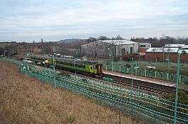
Langwith-Whaley Thorns railway station is in Derbyshire, England. The station is on the Robin Hood Line 22¼ miles (36 km) north of Nottingham towards Worksop.
This station serves the villages of Nether Langwith and Whaley Thorns which are both on the boundary of Derbyshire and Nottinghamshire. It also serves the village of Langwith in Derbyshire.
The Robin Hood Line was opened to reinstate a Nottingham to Worksop service, which ran from 1875 until it was withdrawn in October 1964. After withdrawal the station at Langwith was razed to the ground. When the Robin Hood service was being planned it was decided that, rather than build a new station on the original site in Langwith Maltings, the community would be better served by building the new station about half a mile further North in the larger communities of Nether Langwith and Whaley Thorns. The "old" Langwith station is described at Langwith station (1875-1964).
Services
Monday to Saturdays, there is generally an hourly service northbound towards Worksop and southbound to Mansfield and Nottingham. A Sunday service of four trains in each direction was introduced in December 2008, but was withdrawn north of Mansfield Woodhouse in May 2011.[1]
References
- ↑ GB eNRT May 2011 & December 2015 Editions, Table 55 (Network Rail)
External links
| Wikimedia Commons has media related to Langwith-Whaley Thorns railway station. |
- Train times and station information for Langwith-Whaley Thorns railway station from National Rail
| Preceding station | Following station | |||
|---|---|---|---|---|
| East Midlands Trains |
Coordinates: 53°13′57.7″N 1°12′33.4″W / 53.232694°N 1.209278°W